
- 数据集可用时间
- 1984-03-16T00:00:00Z–2015-10-18T00:00:00Z
- 数据集生产者
- 欧盟 JRC / Google
- 频率
- 1 个月
- 标签
说明
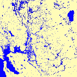
此数据集包含 1984 年至 2015 年地表水的时空分布地图,并提供有关这些水域的范围和变化情况的统计信息。 如需了解详情,请参阅相关期刊文章:High-resolution mapping of global surface water and its long-term changes(《自然》杂志,2016 年)以及在线数据用户指南。
这些数据是使用 1984 年 3 月 16 日至 2015 年 10 月 10 日期间获取的 Landsat 5、7 和 8 的 3,066,102 个场景生成的。 使用专家系统将每个像素单独分类为水 / 非水,并将结果整理成整个时间段和两个时间段(1984 年至 1999 年、2000 年至 2015 年)的每月历史记录,以进行变化检测。
此“每月历史记录”集合按月保存了整个漏水检测历史记录。该合集包含 380 张图片,涵盖 1984 年 3 月至 2015 年 10 月之间的每个月份。
频段
波段
像素大小:30 米(所有波段)
| 名称 | 像元大小 | 说明 | |||||||||||||||||||||||||||||||||||||||||||||||||||||||||||||||||||||||||||||||||||||||||||||||||
|---|---|---|---|---|---|---|---|---|---|---|---|---|---|---|---|---|---|---|---|---|---|---|---|---|---|---|---|---|---|---|---|---|---|---|---|---|---|---|---|---|---|---|---|---|---|---|---|---|---|---|---|---|---|---|---|---|---|---|---|---|---|---|---|---|---|---|---|---|---|---|---|---|---|---|---|---|---|---|---|---|---|---|---|---|---|---|---|---|---|---|---|---|---|---|---|---|---|---|---|
water |
30 米 | 当月的用水量检测。 |
|||||||||||||||||||||||||||||||||||||||||||||||||||||||||||||||||||||||||||||||||||||||||||||||||
图片属性
图像属性
| 名称 | 类型 | 说明 |
|---|---|---|
| 月 | 双精度 | 月 |
| 年 | 双精度 | 年 |
使用条款
使用条款
此处的所有数据均根据哥白尼计划生成,免费提供,不受使用限制。如需了解完整的许可信息,请参阅《哥白尼计划法规》。
使用这些数据集的出版物、模型和数据产品必须包含适当的致谢,包括引用数据集和期刊文章,如以下引用所示。
如果您在已发布的地图中将该数据用作图层,请添加以下提供方文字:“来源:EC JRC/Google”
引用
引用:
Jean-Francois Pekel、Andrew Cottam、Noel Gorelick、Alan S. Belward,全球地表水及其长期变化的高分辨率测绘。Nature 540, 418-422 (2016). (doi:10.1038/nature20584)
通过 Earth Engine 探索
代码编辑器 (JavaScript)
var dataset = ee.ImageCollection('JRC/GSW1_0/MonthlyHistory')
                  .filter(ee.Filter.date('2015-01-01', '2015-12-31'));
var water = dataset.select('water');
var waterVis = {
  min: 0.0,
  max: 2.0,
  palette: ['ffffff', 'fffcb8', '0905ff'],
};
Map.setCenter(-58.999, -3.373, 7);
Map.addLayer(water, waterVis, 'Water');