
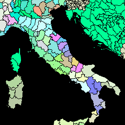
- Доступность набора данных
- 2014-12-19T16:45:00Z–2014-12-19T16:45:00Z
- Производитель наборов данных
- ФАО ООН
- Теги
- границы
Описание
The Global Administrative Unit Layers (GAUL) compiles and disseminates the best available information on administrative units for all the countries in the world, providing a contribution to the standardization of the spatial dataset representing administrative units. The GAUL always maintains global layers with a unified coding system at country, first (eg departments), and second administrative levels (eg districts). Where data is available, it provides layers on a country by country basis down to third, fourth, and lowers levels. The overall methodology consists in a) collecting the best available data from most reliable sources, b) establishing validation periods of the geographic features (when possible), c) adding selected data to the global layer based on the last country boundaries map provided by the UN Cartographic Unit (UNCS), d) generating codes using GAUL Coding System, and e) distribute data to the users (see Technical Aspects of the GAUL Distribution Set . Note that some administrative units are multipolygon features.
Схема таблицы
Схема таблицы
| Имя | Тип | Описание |
|---|---|---|
| ADM0_CODE | ИНТ | код страны GAUL |
| ADM0_NAME | НИТЬ | Название страны ООН |
| DISP_AREA | НИТЬ | Неопределенная ситуация: «Да» или «Нет» |
| СТАТУС | НИТЬ | Статус страны |
| Shape_Area | ДВОЙНОЙ | Форма области |
| Shape_Leng | ДВОЙНОЙ | Длина формы |
| ADM1_CODE | ИНТ | GAUL — код административных единиц первого уровня. |
| ADM1_NAME | НИТЬ | Названия административных единиц первого уровня |
| ADM2_CODE | ИНТ | GAUL — код административных единиц второго уровня. |
| ADM2_NAME | НИТЬ | Названия административных единиц второго уровня |
| EXP2_YEAR | ИНТ | Год истечения срока действия административной единицы |
| STR2_YEAR | ИНТ | Год создания административной единицы |
Условия эксплуатации
Условия эксплуатации
The GAUL dataset is distributed to the United Nations and other authorized international and national institutions/agencies. FAO grants a license to use, download and print the materials contained in the GAUL dataset solely for non-commercial purposes and in accordance with the conditions specified in the data license. The full GAUL Data License document is available for downloading. See also the disclaimer .
Исследуйте мир с помощью Earth Engine.
Редактор кода (JavaScript)
var dataset = ee.FeatureCollection('FAO/GAUL/2015/level2');

Map.setCenter(12.876, 42.682, 5);

var styleParams = {
  fillColor: 'b5ffb4',
  color: '00909F',
  width: 1.0,
};

dataset = dataset.style(styleParams);

Map.addLayer(dataset, {}, 'Second Level Administrative Units');
Визуализируйте как FeatureView
FeatureView — это ускоренное представление FeatureCollection , доступное только для просмотра. Более подробную информацию можно найти в документации FeatureView .
Редактор кода (JavaScript)
var fvLayer = ui.Map.FeatureViewLayer('FAO/GAUL/2015/level2_FeatureView');

var visParams = {
  color: '00909F',
  fillColor: 'b5ffb4',
  opacity: 1,
  width: 1,
  pointSize: 1
};

fvLayer.setVisParams(visParams);
fvLayer.setName('Second Level Administrative Units');

Map.setCenter(7.82, 49.1, 4);
Map.add(fvLayer);