
What Google Public Alerts does
In a crisis, you need to be prepared—and equally important—you need to know what to do. During natural disasters, Google disseminates emergency messages and makes critical information accessible on the Google Public Alerts platform.
For providers of emergency alert data, Google offers tools, instructions, and support to deliver industry-standard warnings and recommendations to the right people at the right time.
Google Public Alerts integrates with Google Search, Google Maps, and notifications on the Google app.
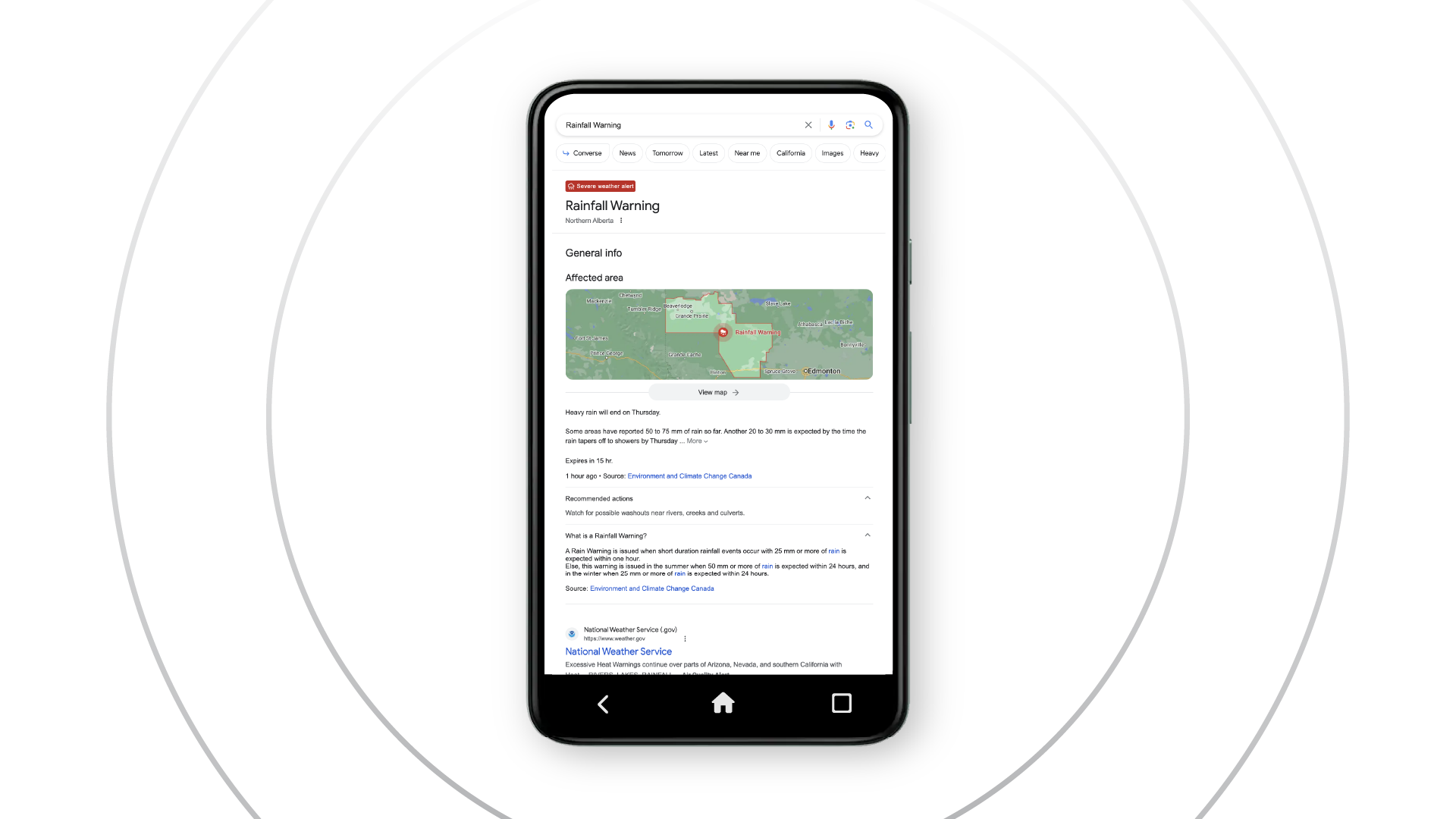
Results in Google Search
If you search for a place where there is a relevant active alert, or from within an affected area where there's a relevant active alert, you'll see a warning, and a link to click through to find out more information.
Local updates on Google Maps
If you're searching Maps on desktop or mobile, you'll get relevant alerts for that area. The Google Maps for Mobile app can also display a warning notification if there is a relevant alert nearby.
Notifications on Google
If there's a relevant active alert for your local area, you'll receive a notification to let you know what's going on, and where.