Datasets tagged usdos in Earth Engine
Mit Sammlungen den Überblick behalten
Sie können Inhalte basierend auf Ihren Einstellungen speichern und kategorisieren.
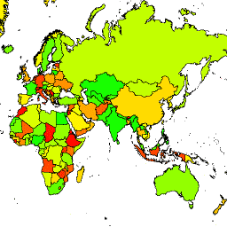
Das US-amerikanische Büro des Geografen stellt den Datensatz „Large Scale International Boundary“ (LSIB) zur Verfügung. Er wird aus zwei anderen Datensätzen abgeleitet: einer LSIB-Linienvektordatei und den World Vector Shorelines (WVS) der National Geospatial-Intelligence Agency (NGA). Die Binnengrenzen spiegeln die Grenzen der US-Regierung wider …
Das US-amerikanische Büro des Geografen stellt den Datensatz „Large Scale International Boundary“ (LSIB) zur Verfügung. Die detaillierte Version (2013) wird aus zwei anderen Datensätzen abgeleitet: einer LSIB-Linienvektordatei und den World Vector Shorelines (WVS) der National Geospatial-Intelligence Agency (NGA). Die Binnengrenzen …
[[["Leicht verständlich","easyToUnderstand","thumb-up"],["Mein Problem wurde gelöst","solvedMyProblem","thumb-up"],["Sonstiges","otherUp","thumb-up"]],[["Benötigte Informationen nicht gefunden","missingTheInformationINeed","thumb-down"],["Zu umständlich/zu viele Schritte","tooComplicatedTooManySteps","thumb-down"],["Nicht mehr aktuell","outOfDate","thumb-down"],["Problem mit der Übersetzung","translationIssue","thumb-down"],["Problem mit Beispielen/Code","samplesCodeIssue","thumb-down"],["Sonstiges","otherDown","thumb-down"]],[],[],["The US Office of the Geographer provides the Large Scale International Boundary (LSIB) dataset. The dataset comes in two versions: detailed and simplified, both derived from an LSIB line vector file and the National Geospatial-Intelligence Agency's (NGA) World Vector Shorelines (WVS). Both versions contain interior boundaries. The dataset includes political borders and information about countries.\n"]]