Page Summary
-
The Malaria Atlas Project provides gap-filled Tasseled Cap Brightness (TCB) and Tasseled Cap Wetness (TCW) datasets at 1km resolution with 8-Daily, Monthly, and Annual temporal resolutions.
-
These datasets were created by applying tasseled-cap equations to MODIS BRDF-corrected imagery (MCD43B4) and then gap-filled to remove missing data.
-
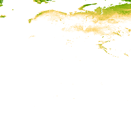
TCB: Malaria Atlas Project Gap-Filled Tasseled Cap Brightness (8-Daily 1km)
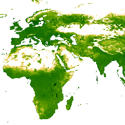
This gap-filled Tasseled Cap Brightness (TCB) dataset was created by applying the tasseled-cap equations defined in Lobser and Cohen (2007) to MODIS BRDF-corrected imagery (MCD43B4). The resulting data were gap-filled using the approach outlined in Weiss et al. (2014) to eliminate missing data caused by … brightness malariaatlasproject map publisher-dataset tasseled-cap tcb -
TCB: Malaria Atlas Project Gap-Filled Tasseled Cap Brightness (Annual 1km)
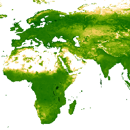
This gap-filled Tasseled Cap Brightness (TCB) dataset was created by applying the tasseled-cap equations defined in Lobser and Cohen (2007) to MODIS BRDF-corrected imagery (MCD43B4). The resulting data were gap-filled using the approach outlined in Weiss et al. (2014) to eliminate missing data caused by … brightness malariaatlasproject map publisher-dataset tasseled-cap tcb -
TCB: Malaria Atlas Project Gap-Filled Tasseled Cap Brightness (Monthly 1km)
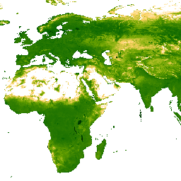
This gap-filled Tasseled Cap Brightness (TCB) dataset was created by applying the tasseled-cap equations defined in Lobser and Cohen (2007) to MODIS BRDF-corrected imagery (MCD43B4). The resulting data were gap-filled using the approach outlined in Weiss et al. (2014) to eliminate missing data caused by … brightness malariaatlasproject map publisher-dataset tasseled-cap tcb -
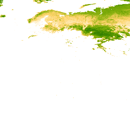
TCW: Malaria Atlas Project Gap-Filled Tasseled Cap Wetness (8-Daily 1km)
This gap-filled Tasseled Cap Wetness (TCW) dataset was created by applying the tasseled-cap equations defined in Lobser and Cohen (2007) to MODIS BRDF-corrected imagery (MCD43B4). The resulting data were gap-filled using the approach outlined in Weiss et al. (2014) to eliminate missing data caused by … malariaatlasproject map publisher-dataset tasseled-cap tcw vegetation -
TCW: Malaria Atlas Project Gap-Filled Tasseled Cap Wetness (Annual 1km)
This gap-filled Tasseled Cap Wetness (TCW) dataset was created by applying the tasseled-cap equations defined in Lobser and Cohen (2007) to MODIS BRDF-corrected imagery (MCD43B4). The resulting data were gap-filled using the approach outlined in Weiss et al. (2014) to eliminate missing data caused by … malariaatlasproject map publisher-dataset tasseled-cap tcw vegetation -
TCW: Malaria Atlas Project Gap-Filled Tasseled Cap Wetness (Monthly 1km)
This gap-filled Tasseled Cap Wetness (TCW) dataset was created by applying the tasseled-cap equations defined in Lobser and Cohen (2007) to MODIS BRDF-corrected imagery (MCD43B4). The resulting data were gap-filled using the approach outlined in Weiss et al. (2014) to eliminate missing data caused by … malariaatlasproject map publisher-dataset tasseled-cap tcw vegetation