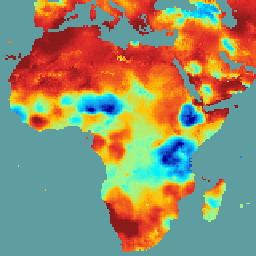
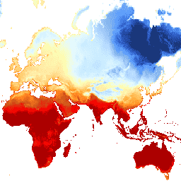
TerraClimate는 전역 지표면의 월별 기후 및 기후적 물 균형 데이터 세트입니다. WorldClim 데이터 세트의 높은 공간 해상도 기후학적 표준을 CRU Ts4.0 및 일본 55년 재분석 (JRA55)의 더 낮은 공간 해상도이지만 시간 가변 데이터와 결합하는 기후적 보조 보간법을 사용합니다. …
[[["이해하기 쉬움","easyToUnderstand","thumb-up"],["문제가 해결됨","solvedMyProblem","thumb-up"],["기타","otherUp","thumb-up"]],[["필요한 정보가 없음","missingTheInformationINeed","thumb-down"],["너무 복잡함/단계 수가 너무 많음","tooComplicatedTooManySteps","thumb-down"],["오래됨","outOfDate","thumb-down"],["번역 문제","translationIssue","thumb-down"],["샘플/코드 문제","samplesCodeIssue","thumb-down"],["기타","otherDown","thumb-down"]],[],[],["The datasets provide drought condition information. SPEIbase offers global drought data with a 0.5-degree resolution and monthly updates, using the Standardized Precipitation-Evapotranspiration Index (SPEI) across 1 to 48-month time scales. GRIDMET DROUGHT provides drought indices like SPI, EDDI, SPEI, and PDSI from 4-km daily Gridded Surface Meteorological data. TerraClimate offers monthly climate and water balance data for global surfaces by interpolating WorldClim, CRU Ts4.0, and JRA55 datasets.\n"]]