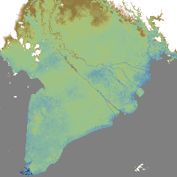
MERIT DEM, दुनिया भर के लिए उपलब्ध एक ऐसा डीईएम है जो ज़्यादा सटीक है. इसका रिज़ॉल्यूशन 3 आर्क सेकंड (~90 मीटर इक्वेटर पर) है. इसे मौजूदा डीईएम (NASA SRTM3 DEM, JAXA AW3D DEM, Viewfinder Panoramas DEM) से मुख्य गड़बड़ियों को हटाकर बनाया गया है. MERIT DEM, ऐब्सलूट बायस, स्ट्राइप नॉइज़, स्पेकल नॉइज़ वगैरह को अलग करता है …
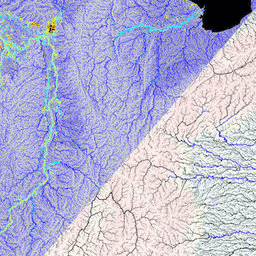
MERIT Hydro, दुनिया भर के लिए उपलब्ध, पानी के बहाव की दिशा दिखाने वाला नया मैप है. इसका रिज़ॉल्यूशन 3 आर्क-सेकंड (~भूमध्य रेखा पर 90 मीटर) है. यह MERIT DEM के वर्शन 1.0.3 के ऊंचाई वाले डेटा और पानी के स्रोत वाले डेटासेट (G1WBM, GSWO, और OpenStreetMap) से लिया गया है. MERIT Hydro में एक नए … का आउटपुट शामिल है
[[["समझने में आसान है","easyToUnderstand","thumb-up"],["मेरी समस्या हल हो गई","solvedMyProblem","thumb-up"],["अन्य","otherUp","thumb-up"]],[["वह जानकारी मौजूद नहीं है जो मुझे चाहिए","missingTheInformationINeed","thumb-down"],["बहुत मुश्किल है / बहुत सारे चरण हैं","tooComplicatedTooManySteps","thumb-down"],["पुराना","outOfDate","thumb-down"],["अनुवाद से जुड़ी समस्या","translationIssue","thumb-down"],["सैंपल / कोड से जुड़ी समस्या","samplesCodeIssue","thumb-down"],["अन्य","otherDown","thumb-down"]],[],[],["MERIT DEM is a high-accuracy global Digital Elevation Model (DEM) with a 3 arc-second resolution. It was created by removing errors from existing DEMs. MERIT Hydro, derived from MERIT DEM, is a global flow direction map, also at 3 arc-second resolution, that uses water body datasets. Supplementary visualization layers for MERIT Hydro are also available. The main actions include the creation of these datasets and the enhancement of resolution and correction of errors.\n"]]