Page Summary
-
This page features datasets related to greenhouse gas emissions, focusing on drained organic soils and methane from various sources.
-
Datasets include estimates of drained organic soil area, carbon and nitrous oxide emissions, and methane concentrations and emissions from both airborne and satellite platforms.
-
Methane data is provided for total atmospheric concentration as well as spatially disaggregated area and point source emissions, particularly in oil and gas regions.
-
Some methane datasets are noted as early public previews and still under development, specifically the area emissions models.
-
A global database mapping oil and gas infrastructure is also included as a related dataset.
-
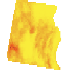
Drained Organic Soils Emissions (Annual) 1.0

The two related FAO datasets on Drained Organic Soils provide estimates of: DROSA-A: area of Organic Soils (in hectares) drained for agricultural activities (cropland and grazed grassland) DROSE-A: carbon (C) and nitrous oxide (N2O) estimates (in gigagrams) from the agricultural drainage of organic soils under … agriculture climate climate-change emissions fao ghg -
MethaneAIR L3 Concentration V1.1.0
This dataset provides geospatial data for the total column dry air mole fraction of methane in the atmosphere, "XCH4", as observed by the MethaneAIR imaging spectrometer. XCH4 is defined as the total column amount (number of molecules) of methane ("CH4") divided by the total amount … atmosphere climate edf edf-methanesat-ee emissions ghg -
MethaneAIR L3 Concentration v1
This dataset provides geospatial data for the total column dry air mole fraction of methane in the atmosphere, "XCH4", as observed by the MethaneAIR imaging spectrometer. XCH4 is defined as the total column amount (number of molecules) of methane ("CH4") divided by the total amount … atmosphere climate edf emissions ghg methane -
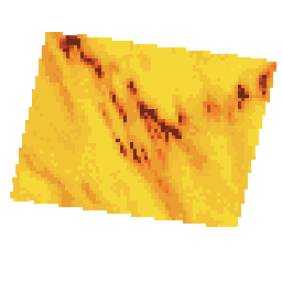
MethaneAIR L4 Area Sources v1
The area emissions model is still in development and not representative of a final product. This dataset provides spatially disaggregated methane emission fluxes (kg/hr) using measurements from MethaneAIR flights focused on oil and gas producing regions throughout the United States. Total emissions for the survey … atmosphere climate edf emissions ghg methane -
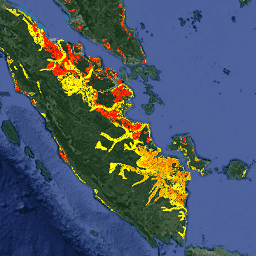
MethaneAIR L4 Point Sources V1.1.0

This dataset provides data for high-emitting methane point source detections (kg/hr) over 13 oil and gas or coal extraction areas from Colorado, New Mexico, and Texas in the west to Pennsylvania, Ohio, and West Virginia in the east, plus three urban areas (New York City, … atmosphere climate edf edf-methanesat-ee emissions ghg -
MethaneAIR L4 Point Sources v1

This dataset provides data for high-emitting methane point source detections (kg/hr) over 13 oil and gas or coal extraction areas from Colorado, New Mexico, and Texas in the west to Pennsylvania, Ohio, and West Virginia in the east, plus three urban areas (New York City, … atmosphere climate edf emissions ghg methane -
MethaneSAT L3 Concentration Public Preview V1.0.0
This early "Public Preview" dataset provides geospatial data for the column-averaged dry-air mole fraction of methane in the atmosphere, "XCH4", retrieved from measurements by the MethaneSAT imaging spectrometer. XCH4 is defined as the total column amount (number of molecules above a unit surface area) of … atmosphere climate edf edf-methanesat-ee emissions ghg -
MethaneSAT L4 Area Sources Public Preview V1.0.0
The dispersed area emissions model is still in development and not representative of a final product. This early "Public Preview" dataset provides high precision data for methane emissions from dispersed area sources. These emissions data come from the Appalachian, Permian, and Uinta basins in the … atmosphere climate edf edf-methanesat-ee emissions ghg -
MethaneSAT L4 Area Sources Public Preview V2.0.0
The dispersed area emissions model is still in development and not representative of a final product. This early "Public Preview" dataset provides high precision data for methane emissions from dispersed area sources. These novel measurements demonstrate the importance of quantifying total methane emissions with high … atmosphere climate edf edf-methanesat-ee emissions ghg -
MethaneSAT L4 Point Sources Public Preview V1.0.0

This early "Public Preview" dataset provides high precision data for methane emissions from discrete point sources. These methane emission fluxes were produced using a point source detection and emissions quantification framework specialized to exploit the high spatial resolution, wide spatial coverage, and high precision of … atmosphere climate edf edf-methanesat-ee emissions ghg -
OGIM: Oil and Gas Infrastructure Mapping Database v2.5.1
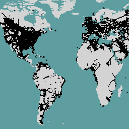
This dataset provides the locations of oil and gas (O&G) related infrastructure globally. The Oil and Gas Infrastructure Mapping (OGIM) database is a project developed by the Environmental Defense Fund (EDF) and MethaneSAT LLC, a wholly-owned subsidiary of EDF. The primary objective of developing a … edf emissions ghg infrastructure-boundaries methane methaneair -
UN FAO Drained Organic Soils Area (Annual) 1.0
The two related FAO datasets on Drained Organic Soils provide estimates of: DROSA-A: area of Organic Soils (in hectares) drained for agricultural activities (cropland and grazed grassland) DROSE-A: carbon (C) and nitrous oxide (N2O) estimates (in gigagrams) from the agricultural drainage of organic soils under … agriculture climate climate-change emissions fao ghg