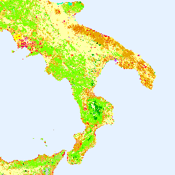
מלאי הנתונים של CORINE (תיאום מידע על הסביבה) Land Cover (CLC) הושק בשנת 1985 כדי לתקנן את איסוף הנתונים על הקרקע באירופה, במטרה לתמוך בפיתוח מדיניות סביבתית. הפרויקט מתואם על ידי European Environment Agency (הסוכנות האירופית לאיכות הסביבה, EEA) במסגרת האיחוד האירופי …
שירות הקרקע הגלובלי של קופרניקוס (CGLS) מיועד להיות רכיב של שירות הקרקע, שיפעיל רכיב שירות רב-תכליתי שמספק סדרה של מוצרים ביו-גיאופיזיים על הסטטוס וההתפתחות של פני הקרקע בקנה מידה גלובלי. מפת כיסוי השטח הדינמית ב…
[[["התוכן קל להבנה","easyToUnderstand","thumb-up"],["התוכן עזר לי לפתור בעיה","solvedMyProblem","thumb-up"],["סיבה אחרת","otherUp","thumb-up"]],[["חסרים לי מידע או פרטים","missingTheInformationINeed","thumb-down"],["התוכן מורכב מדי או עם יותר מדי שלבים","tooComplicatedTooManySteps","thumb-down"],["התוכן לא עדכני","outOfDate","thumb-down"],["בעיה בתרגום","translationIssue","thumb-down"],["בעיה בדוגמאות/בקוד","samplesCodeIssue","thumb-down"],["סיבה אחרת","otherDown","thumb-down"]],[],[],["The Copernicus program provides land cover data through two key initiatives. The CORINE Land Cover (CLC) inventory, initiated in 1985 and coordinated by the EEA, standardizes land data collection in Europe. The Copernicus Global Land Service (CGLS) offers bio-geophysical products and dynamic land cover maps at a global scale, providing insights into land surface status and evolution. Both use the European Union's resources, are associated with the European Environment Agency (EEA), European Space Agency (ESA), and focus on land cover.\n"]]