-
Brazil Forest Imagery Dataset 2008: Analytic Basemap
This dataset provides up to a 10-meter resolution multispectral (green, red, and near-infrared) basemap of Brazil, primarily captured in 2008, to support implementation of the Brazil Forest Code. The mosaic is synthesized from SPOT 2, 4, and 5 satellite data. It serves as a higher-resolution … brazil forest-code google imagery multispectral satellite-imagery -
Brazil Forest Imagery Dataset 2008: Visual Basemap
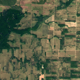
This dataset provides a visual imagery basemap of Brazil with up to 5-meter resolution, primarily captured in 2008, to support implementation of the Brazil Forest Code. The mosaic is synthesized from SPOT 2, 4, and 5 satellite data. It serves as a high-resolution alternative to … brazil deforestation forest-code google rgb satellite-imagery -
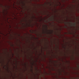
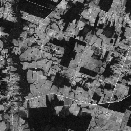
SPOT Multispectral Imagery 10-20m, Brazil
This collection provides 2008-era raw multispectral imagery from the SPOT 2, 4, and 5 satellites over the country of Brazil. These missions, operated by CNES, were designed to provide high-resolution, wide-area optical imagery for managing Earth's resources. SPOT 2 and 4 utilized HRV and HRVIR … brazil forest-code google multispectral satellite-imagery spot -
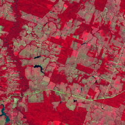
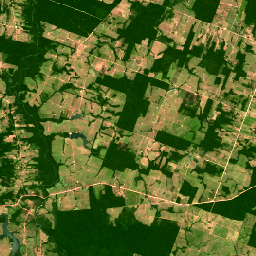
SPOT Multispectral Pseudo Natural Color Imagery 10-20m, Brazil
This collection contains 2008-era "pseudo natural color" RGB images derived from the native multispectral bands of SPOT 2, 4, and 5 for Brazil. Because the HRV and HRG sensors did not include a native blue band, this product synthesizes an RGB representation to approximate a … brazil forest-code google rgb satellite-imagery spot -
SPOT Panchromatic Imagery 5-10m, Brazil
This collection contains the raw panchromatic (PAN) bands from the SPOT 2, 4, and 5 satellites for Brazil circa 2008. The panchromatic sensor provides the highest native spatial resolution of the missions, capturing light across a broad visible spectrum (0.51-0.73 µm for SPOT 2, 0.61-0.68 … brazil forest-code google imagery satellite-imagery spot -
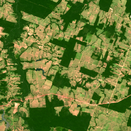
SPOT Pansharpened Pseudo Natural Color Imagery 5-10m, Brazil
This collection provides high-resolution pansharpened pseudo-natural color SPOT imagery satellites 2, 4, and 5 for Brazil circa 2008. Where a corresponding high-resolution panchromatic image was available, it was fused with multispectral data to achieve enhanced spatial detail (up to 5m for SPOT 5 or 10m … brazil forest-code google rgb satellite-imagery spot