Page Summary
-
The NICFI Satellite Data Program provides high-resolution satellite monitoring of tropical forests in Africa, the Americas, and Asia.
-
The primary purpose of this data is to help reduce and reverse the loss of tropical forests.
-
Access to this data contributes to combating climate change, conserving biodiversity, and facilitating sustainable development.
-
NICFI Satellite Data Program Basemaps for Tropical Forest Monitoring - Africa
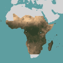
This image collection provides access to high-resolution satellite monitoring of the tropics for the primary purpose of reducing and reversing the loss of tropical forests, contributing to combating climate change, conserving biodiversity, contributing to forest regrowth, restoration and enhancement, and facilitating sustainable development, all of … basemaps forest nicfi planet planet-nicfi publisher-dataset -
NICFI Satellite Data Program Basemaps for Tropical Forest Monitoring - Americas
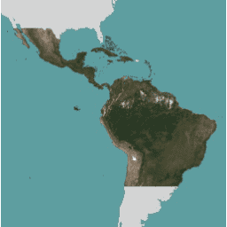
This image collection provides access to high-resolution satellite monitoring of the tropics for the primary purpose of reducing and reversing the loss of tropical forests, contributing to combating climate change, conserving biodiversity, contributing to forest regrowth, restoration and enhancement, and facilitating sustainable development, all of … basemaps forest nicfi planet planet-nicfi publisher-dataset -
NICFI Satellite Data Program Basemaps for Tropical Forest Monitoring - Asia
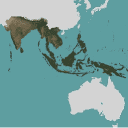
This image collection provides access to high-resolution satellite monitoring of the tropics for the primary purpose of reducing and reversing the loss of tropical forests, contributing to combating climate change, conserving biodiversity, contributing to forest regrowth, restoration and enhancement, and facilitating sustainable development, all of … basemaps forest nicfi planet planet-nicfi publisher-dataset