
Page Summary
-
Datasets offer spatial information on forest characteristics including biomass and carbon.
-
Data is available globally and for specific regions like the United States and tropical countries.
-
Resolutions vary across datasets, including approximately 30m, 300m, and 500m.
-
Datasets support applications like estimating Aboveground dry woody Biomass Density and tracking forest characteristics over time.
-
Global 2020 Forest Classification for IPCC Aboveground Biomass Tier 1 Estimates, V1

This dataset provides classes of global forests delineated by status/condition in 2020 at approximately 30m resolution. The data support generating Tier 1 estimates for Aboveground dry woody Biomass Density (AGBD) in natural forests in the 2019 Refinement to the 2006 IPCC Guidelines for National Greenhouse … aboveground biomass carbon classification forest forest-biomass -
Global Aboveground and Belowground Biomass Carbon Density Maps
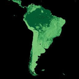
This dataset provides temporally consistent and harmonized global maps of aboveground and belowground biomass carbon density for the year 2010 at a 300-m spatial resolution. The aboveground biomass map integrates land-cover specific, remotely sensed maps of woody, grassland, cropland, and tundra biomass. Input maps were … aboveground biomass carbon density forest forest-biomass -
USFS TreeMap 2023-1

TreeMap datasets provide detailed spatial information on forest characteristics across the entire forested extent of the Conterminous United States (CONUS) for the years 2016, 2020, 2022, and 2023. TreeMap 2014 is also available for CONUS but not included in this data archive. TreeMap 2024 is … aboveground biomass carbon climate-change conus forest -
WHRC Pantropical National Level Carbon Stock Dataset
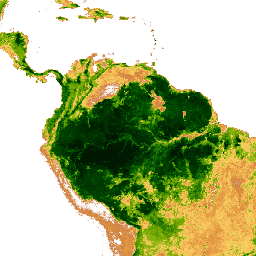
A national-level map of above-ground live woody biomass density for tropical countries at 500m. This dataset was assembled from a combination of co-located field measurements, LiDAR observations, and imagery recorded from the Moderate Resolution Imaging Spectroradiometer (MODIS). aboveground biomass carbon forest-biomass geophysical umd