Page Summary
-
Planet provides daily satellite data to help understand the physical world.
-
Through Norway's International Climate & Forests Initiative (NICFI), users can access Planet's high-resolution data of tropical forests for non-commercial purposes.
-
The data helps reduce and reverse tropical forest loss, combat climate change, conserve biodiversity, and facilitate sustainable development.
-
High-resolution satellite monitoring of the tropics is available for Africa, Americas, and Asia.
businesses, governments, researchers, and journalists understand the physical world and take action.
Through Norway's International Climate and Forest Initiative (NICFI), users can now access Planet’s high-resolution, analysis-ready mosaics of the world’s tropics in order to help reduce and reverse the loss of tropical forests, combat climate change, conserve biodiversity, and facilitate sustainable development for non commercial uses.
-
NICFI Satellite Data Program Basemaps for Tropical Forest Monitoring - Africa
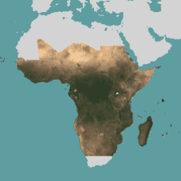
This image collection provides access to high-resolution satellite monitoring of the tropics for the primary purpose of reducing and reversing the loss of tropical forests, contributing to combating climate change, conserving biodiversity, contributing to forest regrowth, restoration and enhancement, and facilitating sustainable development, all of … basemaps forest nicfi planet planet-nicfi publisher-dataset -
NICFI Satellite Data Program Basemaps for Tropical Forest Monitoring - Americas

This image collection provides access to high-resolution satellite monitoring of the tropics for the primary purpose of reducing and reversing the loss of tropical forests, contributing to combating climate change, conserving biodiversity, contributing to forest regrowth, restoration and enhancement, and facilitating sustainable development, all of … basemaps forest nicfi planet planet-nicfi publisher-dataset -
NICFI Satellite Data Program Basemaps for Tropical Forest Monitoring - Asia
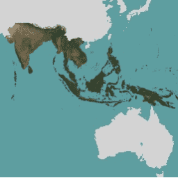
This image collection provides access to high-resolution satellite monitoring of the tropics for the primary purpose of reducing and reversing the loss of tropical forests, contributing to combating climate change, conserving biodiversity, contributing to forest regrowth, restoration and enhancement, and facilitating sustainable development, all of … basemaps forest nicfi planet planet-nicfi publisher-dataset