
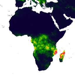
- 数据集可用时间
- 1981-01-01T00:00:00Z–2026-09-30T00:00:00Z
- 数据集生成器
- UCSB/CHG
- 时间分辨率
- 1 天
- 标记
说明
气候灾害中心红外降水与站点数据 (CHIRPS) 是一个 30 多年的准全球降雨数据集。CHIRPS 将 0.05° 分辨率的卫星图像与原位站数据相结合,创建网格化降雨量时序,用于趋势分析和季节性干旱监测。
频段
波段
像素大小:5566 米(所有波段)
| 名称 | 单位 | 最小值 | 最大值 | 像素大小 | 说明 |
|---|---|---|---|---|---|
precipitation |
毫米/天 | 0* | 1444.34* | 5566 米 | 降水概率 |
使用条款
使用条款
此数据集属于公共领域。在法律允许的最大范围内,Pete Peterson 已放弃对气候灾害中心红外降水与站点 (CHIRPS) 的所有版权和相关或邻接权。
引用
引用:
Funk, Chris, Pete Peterson, Martin Landsfeld, Diego Pedreros, James Verdin, Shraddhanand Shukla, Gregory Husak, James Rowland, Laura Harrison, Andrew Hoell & Joel Michaelsen. “The climate hazards infrared precipitation with stations-a new environmental record for monitoring extremes”。 《科学数据》2, 150066. doi:10.1038/sdata.2015.66 2015.
通过 Earth Engine 探索
代码编辑器 (JavaScript)
var dataset = ee.ImageCollection('UCSB-CHG/CHIRPS/DAILY')
                  .filter(ee.Filter.date('2018-05-01', '2018-05-03'));
var precipitation = dataset.select('precipitation');
var precipitationVis = {
  min: 1,
  max: 17,
  palette: ['001137', '0aab1e', 'e7eb05', 'ff4a2d', 'e90000'],
};
Map.setCenter(17.93, 7.71, 2);
Map.addLayer(precipitation, precipitationVis, 'Precipitation');
import ee
import geemap.core as geemap
Colab (Python)
dataset = ee.ImageCollection('UCSB-CHG/CHIRPS/DAILY').filter(
    ee.Filter.date('2018-05-01', '2018-05-03')
)
precipitation = dataset.select('precipitation')
precipitation_vis = {
    'min': 1,
    'max': 17,
    'palette': ['001137', '0aab1e', 'e7eb05', 'ff4a2d', 'e90000'],
}

m = geemap.Map()
m.set_center(17.93, 7.71, 2)
m.add_layer(precipitation, precipitation_vis, 'Precipitation')
m