- Dataset Availability
- 2023-01-01T00:00:00Z–2025-01-01T00:00:00Z
- Dataset Producer
- NASA JPL
- Tags
Description
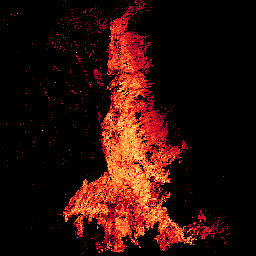
The Observational Products for End-Users from Remote Sensing Analysis (OPERA) Land Surface Disturbance Annual from Harmonized Landsat Sentinel-2 (DIST-ANN-HLS) product Version 1 summarizes the DIST-ALERT data product into an annual vegetation disturbance data product.
The DIST-ANN-HLS product provides annual metrics and classifications of vegetation disturbance detected from Harmonized Landsat-8/9 and Sentinel-2A/B (HLS) surface reflectance data at 30-meter resolution. Disturbances include abrupt events such as wildfire, logging, and clearing, as well as ongoing or longer-term changes. The product includes both vegetation-specific disturbance metrics (VEG) and generic disturbance metrics (GEN) across 21 raster layers.
Documentation:
Bands
Bands
Pixel size: 30 meters (all bands)
| Name | Units | Pixel Size | Description |
|---|---|---|---|
VEG-DIST-STATUS |
30 meters | Status of vegetation disturbance within the calendar year. |
|
VEG-ANOM-MAX |
% | 30 meters | Maximum vegetation loss anomaly observed during the year. |
VEG-DIST-DATE |
d | 30 meters | Day of initial vegetation disturbance detection, denoted as the number of days since December 31, 2020. |
VEG-DIST-DUR |
d | 30 meters | Duration of reported vegetation disturbance event in days. |
VEG-DIST-CONF |
30 meters | Confidence level of vegetation disturbance detection. |
|
VEG-DIST-COUNT |
count | 30 meters | Count of observations with detected vegetation loss for the reported event. |
VEG-CONF-PREV |
30 meters | Reported vegetation loss alert from previous year confirmed in current year. |
|
VEG-CONF-COUNT |
count | 30 meters | Count of separate vegetation disturbance events during the calendar year. |
VEG-LAST-DATE |
d | 30 meters | Day of last observation for vegetation disturbance monitoring, denoted as the number of days since December 31, 2020. |
VEG-HIST |
% | 30 meters | Vegetation cover percent of baseline at time of maximum anomaly (0-100%, 200 = no disturbance). |
VEG-IND-MAX |
% | 30 meters | Maximum estimated vegetation cover, with disturbance areas having the vegetation cover from the date of maximum anomaly (0-100%). |
VEG-IND-3YR-MIN |
% | 30 meters | Minimum vegetation cover percent over the current and previous two years. |
GEN-DIST-STATUS |
30 meters | Status of generic spectral disturbance within the calendar year. |
|
GEN-ANOM-MAX |
30 meters | Maximum generic spectral anomaly observed during the year. |
|
GEN-DIST-DATE |
d | 30 meters | Day of initial generic disturbance detection, denoted as the number of days since December 31, 2020. |
GEN-DIST-DUR |
d | 30 meters | Duration of reported generic disturbance event in days. |
GEN-DIST-CONF |
30 meters | Confidence level of generic disturbance detection. |
|
GEN-DIST-COUNT |
count | 30 meters | Count of observations with detected generic disturbance for the reported event. |
GEN-CONF-PREV |
30 meters | Reported generic disturbance alert from previous year confirmed in current year. |
|
GEN-CONF-COUNT |
count | 30 meters | Count of separate generic disturbance events during the calendar year. |
GEN-LAST-DATE |
d | 30 meters | Day of last observation for generic disturbance monitoring, denoted as the number of days since December 31, 2020. |
VEG-DIST-STATUS Class Table
| Value | Color | Description |
|---|---|---|
| 0 | #121212 | No disturbance detected |
| 3 | #dee043 | Confirmed <50% ongoing disturbance |
| 6 | #e01b07 | Confirmed >=50% ongoing disturbance |
| 7 | #777777 | Confirmed <50% finished disturbance |
| 8 | #dddddd | Confirmed >=50% finished disturbance |
| 9 | #333333 | Confirmed <50% disturbance from previous year |
| 10 | #444444 | Confirmed >=50% disturbance from previous year |
VEG-CONF-PREV Class Table
| Value | Color | Description |
|---|---|---|
| 0 | #121212 | No disturbance |
| 1 | #d7ccc8 | Confirmed low previous year |
| 2 | #8d6e63 | Confirmed high previous year |
GEN-DIST-STATUS Class Table
| Value | Color | Description |
|---|---|---|
| 0 | #121212 | No disturbance detected |
| 3 | #dee043 | Confirmed <50% ongoing disturbance |
| 6 | #e01b07 | Confirmed >=50% ongoing disturbance |
| 7 | #777777 | Confirmed <50% finished disturbance |
| 8 | #dddddd | Confirmed >=50% finished disturbance |
| 9 | #333333 | Confirmed <50% disturbance from previous year |
| 10 | #444444 | Confirmed >=50% disturbance from previous year |
GEN-CONF-PREV Class Table
| Value | Color | Description |
|---|---|---|
| 0 | #121212 | No disturbance |
| 1 | #d7ccc8 | Confirmed low previous year |
| 2 | #8d6e63 | Confirmed high previous year |
Image Properties
Image Properties
| Name | Type | Description |
|---|---|---|
| Percent_data | DOUBLE | Percentage of valid data pixels within the granule tile footprint. |
Terms of Use
Terms of Use
This dataset is openly shared, without restriction, in accordance with the EOSDIS Data Use and Citation Guidance
Citations
Hansen, M. (2024). OPERA Land Surface Disturbance Annual from Harmonized Landsat Sentinel-2 product (Version 1) [Dataset]. NASA Land Processes Distributed Active Archive Center. https://doi.org/10.5067/SNWG/OPERA_L3_DIST-ANN-HLS_V1.001
Pickens, A. H., Hansen, M. C., Song, Z., Poulson, A., Komarova, A., Baggett, A., Kerr, T., Mikus, A., Dominguez, C. O., Tyukavina, A., & Lima, A. (2025). Rapid monitoring of global land change. Nature Communications, 16, 8820. https://doi.org/10.1038/s41467-025-64014-9
DOIs
Explore with Earth Engine
Code Editor (JavaScript)
var dataset = ee.ImageCollection('OPERA/DIST/L3_DIST-ANN-HLS/V1')
    .filterDate('2025-01-01', '2026-01-01');

var dist = dataset.select('VEG-DIST-STATUS').mosaic();

Map.setCenter(29.81, 2.02, 11);

var statusVis = {
  min: 0,
  max: 10,
  palette: [
    '121212', // 0: No disturbance detected (dark)
    '000000', // Not used
    '000000', // Not used
    'dee043', // 3: Confirmed <50% ongoing disturbance (yellow)
    '000000', // Not used
    '000000', // Not used
    'e01b07', // 6: Confirmed >=50% ongoing disturbance (red)
    '777777', // 7: Confirmed <50% finished disturbance (gray)
    'dddddd', // 8: Confirmed >=50% finished disturbance (very light gray)
    '333333', // 9: Confirmed <50% disturbance from previous year (darkest gray)
    '444444', // 10: Confirmed >=50% disturbance from previous year (dark gray)
  ],
};

Map.addLayer(dist, statusVis, 'Vegetation Disturbance Status');