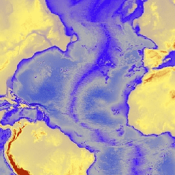
ETOPO1은 육지 지형과 해양 지형을 통합한 지구 표면의 1분 전 세계 지형 모델입니다. 이 모델은 수많은 글로벌 및 지역 데이터 세트를 기반으로 구축되었습니다. 여기에는 ice_surface와 bedrock이라는 두 개의 고도 대역이 포함되어 있습니다.
대역
대역
픽셀 크기: 1,855m (모든 밴드)
이름
단위
최소
최대
픽셀 크기
설명
bedrock
m
-10898*
8271*
1,855미터
지상 및 남극과 그린란드 빙상의 기저부의 고도
ice_surface
m
-10898*
8271*
1,855미터
지상 및 남극과 그린란드 빙상의 상단에서의 고도
* 예상 최솟값 또는 최댓값
이용약관
이용약관
ETOPO1 또는 퍼블릭 도메인에 있는 기타 NOAA 제품을 사용하기 위해 서면 허가를 받을 필요는 없으며, 사용료도 없습니다. NCEI를 출처로 인용하기만 하면 됩니다.
인용
인용:
Amante, C. and B. W. Eakins, ETOPO1 1 Arc-Minute Global Relief
Model: Procedures, Data Sources and Analysis. NOAA 기술 메모
NESDIS NGDC-24, 19페이지, 2009년 3월.
[[["이해하기 쉬움","easyToUnderstand","thumb-up"],["문제가 해결됨","solvedMyProblem","thumb-up"],["기타","otherUp","thumb-up"]],[["필요한 정보가 없음","missingTheInformationINeed","thumb-down"],["너무 복잡함/단계 수가 너무 많음","tooComplicatedTooManySteps","thumb-down"],["오래됨","outOfDate","thumb-down"],["번역 문제","translationIssue","thumb-down"],["샘플/코드 문제","samplesCodeIssue","thumb-down"],["기타","otherDown","thumb-down"]],[],[],["The NOAA ETOPO1 dataset, available from 2008-08-01, provides a 1 arc-minute global relief model integrating land topography and ocean bathymetry. It includes `bedrock` and `ice_surface` elevation bands, each with a pixel size of 1855 meters. The dataset, accessible via Google Earth Engine using `ee.Image(\"NOAA/NGDC/ETOPO1\")`, is free to use with proper citation of NCEI as the source and is built from multiple global and regional datasets.\n"]]