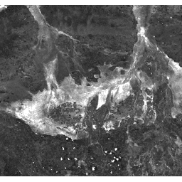
焼失面積指数(BAI)は、赤色バンドと近赤外バンドから生成され、各ピクセルのスペクトル距離を基準スペクトル点(木炭の測定反射率)から測定します。このインデックスは、火災後の画像で炭のシグナルを強調することを目的としています。詳しくは、Chuvieco et al.(2002 年)をご覧ください。このプロダクトは、MODIS/MOD09GA 地表反射率コンポジットから生成されます。
バンド
バンド
ピクセルサイズ: 463.313 メートル(すべてのバンド)
名前
ピクセルサイズ
説明
BAI
463.313 メートル
焼損面積指数
利用規約
利用規約
LP DAAC を通じて取得した MODIS データとプロダクトには、その後の使用、販売、再配布に関する制限はありません。
[[["わかりやすい","easyToUnderstand","thumb-up"],["問題の解決に役立った","solvedMyProblem","thumb-up"],["その他","otherUp","thumb-up"]],[["必要な情報がない","missingTheInformationINeed","thumb-down"],["複雑すぎる / 手順が多すぎる","tooComplicatedTooManySteps","thumb-down"],["最新ではない","outOfDate","thumb-down"],["翻訳に関する問題","translationIssue","thumb-down"],["サンプル / コードに問題がある","samplesCodeIssue","thumb-down"],["その他","otherDown","thumb-down"]],[],[],["The Burn Area Index (BAI) dataset, derived from MODIS/MOD09GA surface reflectance, measures the spectral distance of each pixel from a charcoal reflectance reference, highlighting charcoal presence in post-fire images. This daily global dataset, available from February 24, 2000, to March 30, 2017, with a 463.313-meter pixel size, is now superseded by a newer version. Access to this dataset is free for research, education, and nonprofit use via the Earth Engine platform.\n"]]