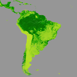
Terra MODIS 植被連續場 (VCF) 產品是全球地表植被覆蓋估計值的次像素級表示法。這項資料集會持續以基本植被特徵的比例,呈現地球陸地表面,並提供三種地表覆蓋成分的漸層:樹木覆蓋率百分比、非樹木覆蓋率百分比和裸地百分比。VCF 產品可持續量化呈現地表覆蓋情形,並提供更精細的空間資訊,因此廣泛用於環境模擬和監控應用程式。
VCF 產品每年生成一次,是使用 Terra MODIS 250 和 500 公尺陸地表面反射率資料的每月複合資料製作而成,包括所有七個頻帶和陸地表面溫度。
[[["容易理解","easyToUnderstand","thumb-up"],["確實解決了我的問題","solvedMyProblem","thumb-up"],["其他","otherUp","thumb-up"]],[["缺少我需要的資訊","missingTheInformationINeed","thumb-down"],["過於複雜/步驟過多","tooComplicatedTooManySteps","thumb-down"],["過時","outOfDate","thumb-down"],["翻譯問題","translationIssue","thumb-down"],["示例/程式碼問題","samplesCodeIssue","thumb-down"],["其他","otherDown","thumb-down"]],[],[],["The Terra MODIS VCF product, available from 2000-03-05 to 2023-03-06 via NASA LP DAAC, offers yearly global vegetation cover data. It uses 250-meter resolution to estimate percent tree cover, non-tree vegetation, and bare ground. Data is derived from Terra MODIS Land Surface Reflectance. The product includes quality and cloud data indicators. Access to use is through google Earth engine, with JavaScript code examples for visualization.\n"]]