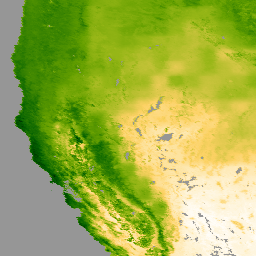
Terra Moderate Resolution Imaging Spectroradiometer (MODIS) MOD16A2GF 버전 6.1 증발산량/잠열 플럭스 (ET/LE) 제품은 500미터 (m) 픽셀 해상도로 생성된 연말 갭 필링 8일 복합 데이터 세트입니다. MOD16 데이터 제품 컬렉션에 사용되는 알고리즘은 일일 기상 재분석 데이터와 MODIS 원격 감지 데이터 제품(예: 식물 속성 역학, 알베도, 토지 피복)의 입력을 포함하는 Penman-Monteith 방정식의 논리를 기반으로 합니다.
두 증발산량 레이어 (ET 및 PET)의 픽셀 값은 합성 기간 내의 8일의 합계이고, 두 잠열 레이어 (LE 및 PLE)의 픽셀 값은 합성 기간 내의 8일의 평균입니다. 매년 마지막 획득 기간은 연도에 따라 5일 또는 6일의 복합 기간입니다.
Terra Moderate Resolution Imaging Spectroradiometer (MODIS) MOD16A2GF 버전 6.1 증발산량/잠열 플럭스 (ET/LE) 제품은 500미터 (m) 픽셀 해상도로 생성된 연말 갭 채우기 8일 합성 데이터 세트입니다. MOD16 데이터 제품 컬렉션에 사용되는 알고리즘은 Penman-Monteith 방정식의 논리를 기반으로 하며 여기에는 다음 입력이 포함됩니다.
[[["이해하기 쉬움","easyToUnderstand","thumb-up"],["문제가 해결됨","solvedMyProblem","thumb-up"],["기타","otherUp","thumb-up"]],[["필요한 정보가 없음","missingTheInformationINeed","thumb-down"],["너무 복잡함/단계 수가 너무 많음","tooComplicatedTooManySteps","thumb-down"],["오래됨","outOfDate","thumb-down"],["번역 문제","translationIssue","thumb-down"],["샘플/코드 문제","samplesCodeIssue","thumb-down"],["기타","otherDown","thumb-down"]],[],[],["The NASA MODIS MOD16A2GF Version 6.1 dataset provides 8-day composite data of evapotranspiration (ET) and latent heat flux (LE) at a 500-meter resolution, available from 2000-01-01 to 2024-12-26. It uses the Penman-Monteith equation and includes MODIS-sensed data. Data values represent eight-day totals for ET and potential ET, and daily averages for LE and potential LE. Access is through Google Earth Engine with examples available. The data is freely available for any use, sale, or redistribution.\n"]]