MYD14A1 V6 데이터 세트는 MODIS 4 및 11마이크로미터 복사휘도에서 파생된 1km 해상도의 일일 화재 마스크 컴포지트를 제공합니다.
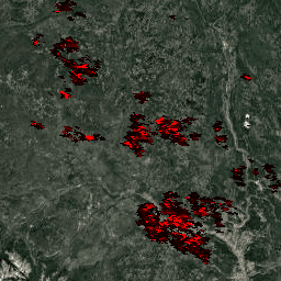
화재 감지 전략은 화재의 절대 감지 (화재 강도가 감지하기에 충분한 경우)와 배경에 대한 상대적 감지 (표면 온도와 햇빛에 의한 반사의 변동성을 고려)를 기반으로 합니다. 제품은 화재, 비화재, 관찰되지 않음을 구분합니다. 이 정보는 다양한 생태계에서 화재의 공간적 및 시간적 분포를 모니터링하고, 화재 분포의 변화를 감지하고, 새로운 화재 발생 지역, 산불, 화재 빈도 또는 상대적 강도의 변화를 식별하는 데 사용됩니다.
[[["이해하기 쉬움","easyToUnderstand","thumb-up"],["문제가 해결됨","solvedMyProblem","thumb-up"],["기타","otherUp","thumb-up"]],[["필요한 정보가 없음","missingTheInformationINeed","thumb-down"],["너무 복잡함/단계 수가 너무 많음","tooComplicatedTooManySteps","thumb-down"],["오래됨","outOfDate","thumb-down"],["번역 문제","translationIssue","thumb-down"],["샘플/코드 문제","samplesCodeIssue","thumb-down"],["기타","otherDown","thumb-down"]],[],[],["The MYD14A1 V6 dataset offers daily 1km resolution fire mask composites from MODIS radiances, available from 2002-07-04 to 2023-02-25. Fire detection uses absolute and relative methods, distinguishing between fire, no fire, and no observation. The dataset includes fire confidence, maximum fire radiative power (MaxFRP), sample position, and quality indicators. Users can access data through Google Earth Engine using provided code snippets and there are no usage restrictions. The data is now superseded by a newer dataset: MODIS/061/MYD14A1.\n"]]