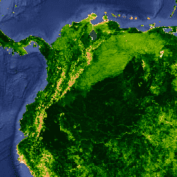
MYD13A1 V6 제품은 픽셀별로 식생 지수 (VI) 값을 제공합니다. 두 가지 주요 식생층이 있습니다.
첫 번째는 정규 식생 지수 (NDVI)로, 기존 국립해양대기청-고해상도 가시광선 및 적외선 스캐너 (NOAA-AVHRR)에서 파생된 NDVI에 대한 연속성 지수라고 합니다. 두 번째 식생 레이어는 캐노피 배경 변동을 최소화하고 밀집된 식생 조건에서 민감도를 유지하는 향상된 식생 지수 (EVI)입니다.
EVI는 파란색 밴드를 사용하여 연기와 하위 픽셀 얇은 구름으로 인한 잔여 대기 오염도 제거합니다. MODIS NDVI 및 EVI 제품은 물, 구름, 심한 에어로졸, 구름 그림자로 마스크 처리된 대기 보정 양방향 표면 반사율에서 계산됩니다.
[[["이해하기 쉬움","easyToUnderstand","thumb-up"],["문제가 해결됨","solvedMyProblem","thumb-up"],["기타","otherUp","thumb-up"]],[["필요한 정보가 없음","missingTheInformationINeed","thumb-down"],["너무 복잡함/단계 수가 너무 많음","tooComplicatedTooManySteps","thumb-down"],["오래됨","outOfDate","thumb-down"],["번역 문제","translationIssue","thumb-down"],["샘플/코드 문제","samplesCodeIssue","thumb-down"],["기타","otherDown","thumb-down"]],[],[],["This dataset, MODIS/006/MYD13A1, offers 16-day vegetation index (VI) data at a 500-meter pixel size from 2002 to 2023, with a caution that it is superseded by MODIS/061/MYD13A1. It includes the Normalized Difference Vegetation Index (NDVI) and the Enhanced Vegetation Index (EVI), calculated from atmospherically corrected surface reflectances. The data is provided by NASA LP DAAC at the USGS EROS Center, and has no restrictions on usage.\n"]]