- Dataset Availability
- 2019-04-18T00:00:00Z–2023-03-16T00:00:00Z
- Dataset Producer
- ORNL DAAC
- Tags
Description
The GEDI Level 4D (L4D) product provides a 30-m spatial elaboration of the mission's sample of footprint-level L2A V002, L2B V002, and L4A Version 2.1 products globally between latitudes -51.6 and 51.6 degrees.
A k-nearest neighbors (k-NN) algorithm was used with Landsat time series data to impute high-quality GEDI shots to every 30-m pixel. A different nearest neighbor model was developed for every 10 x 10-km tile, with potential imputed shots drawn from a support area of at least 30 x 30 km centered on the tile. The imputation assigns the single nearest neighbor using Landsat time series imagery centered on the target year 2023.
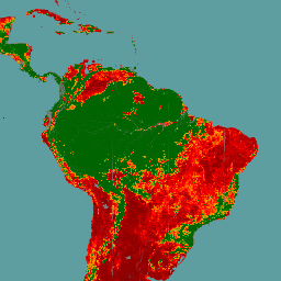
The most basic 30-m output is the shot number of the imputed pixel (relayed in fragments across five fields), from which any shot-level quantity may be retrieved. Predictions for commonly used waveform attributes are also included, such as relative height (RH) metrics from the L2A product, canopy cover from L2B, and aboveground biomass density (AGBD) from L4A.
See User Guide for more information.
The Global Ecosystem Dynamics Investigation GEDI mission aims to characterize ecosystem structure and dynamics to enable radically improved quantification and understanding of the Earth's carbon cycle and biodiversity. The GEDI instrument, attached to the International Space Station (ISS), collects data globally between 51.6° N and 51.6° S latitudes at the highest resolution and densest sampling of the 3-dimensional structure of the Earth. The GEDI instrument consists of three lasers producing a total of eight beam ground transects, which instantaneously sample eight ~25 m footprints spaced approximately every 60 m along-track.
| Product | Description |
|---|---|
| L2A Vector | LARSE/GEDI/GEDI02_A_002 |
| L2A Monthly raster | LARSE/GEDI/GEDI02_A_002_MONTHLY |
| L2A table index | LARSE/GEDI/GEDI02_A_002_INDEX |
| L2B Vector | LARSE/GEDI/GEDI02_B_002 |
| L2B Monthly raster | LARSE/GEDI/GEDI02_B_002_MONTHLY |
| L2B table index | LARSE/GEDI/GEDI02_B_002_INDEX |
| L4A Biomass Vector | LARSE/GEDI/GEDI04_A_002 |
| L4A Monthly raster | LARSE/GEDI/GEDI04_A_002_MONTHLY |
| L4A table index | LARSE/GEDI/GEDI04_A_002_INDEX |
| L4B Biomass | LARSE/GEDI/GEDI04_B_002 |
| L4D Imputed Waveforms | LARSE/GEDI/GEDI04_D_002 |
Bands
Bands
Pixel size: 30 meters (all bands)
| Name | Pixel Size | Description |
|---|---|---|
rh10 |
30 meters | Relative Height metric (rh10) |
rh20 |
30 meters | Relative Height metric (rh20) |
rh30 |
30 meters | Relative Height metric (rh30) |
rh40 |
30 meters | Relative Height metric (rh40) |
rh50 |
30 meters | Relative Height metric (rh50) |
rh60 |
30 meters | Relative Height metric (rh60) |
rh70 |
30 meters | Relative Height metric (rh70) |
rh80 |
30 meters | Relative Height metric (rh80) |
rh90 |
30 meters | Relative Height metric (rh90) |
rh95 |
30 meters | Relative Height metric (rh95) |
rh98 |
30 meters | Relative Height metric (rh98) |
cover_z_000 |
30 meters | Canopy Cover |
agbd |
30 meters | Aboveground Biomass Density |
sensitivity_a2 |
30 meters | Sensitivity |
shot_orbit |
30 meters | Orbit component of shot number |
shot_beam |
30 meters | Beam component of shot number |
shot_future |
30 meters | Future component of shot number |
shot_granule |
30 meters | Granule component of shot number |
shot_index |
30 meters | Shot Index component of shot number |
QA |
30 meters | Quality Assessment mask |
QA Class Table
| Value | Color | Description |
|---|---|---|
| 0 | None | No data (pixel outside zone boundary) |
| 1 | None | Valid data |
| 2 | None | No data (unavailability of cloud-free CCDC input features) |
| 3 | None | No data (nearest shot number truncated in GEE L2A product) |
| 4 | None | Masked out (pixels corresponding to permanent water bodies) |
Terms of Use
Terms of Use
This dataset is in the public domain and is available without restriction on use and distribution. See NASA's Earth Science Data & Information Policy for additional information.
Citations
Seo, E., Healey, S. P., Yang, Z., Dubayah, R. O., De Conto, T., & Armston, J. (2025). GEDI L4D Imputed Waveforms, Version 2 (Version 2). ORNL Distributed Active Archive Center. https://doi.org/10.3334/ORNLDAAC/2455
DOIs
Explore with Earth Engine
Code Editor (JavaScript)
var dataset = ee.ImageCollection('LARSE/GEDI/GEDI04_D_002');

var visualization = {
  bands: ['agbd'],
  min: 1.0,
  max: 60.0,
  palette: [
    'darkred',
    'red',
    'orange',
    'green',
    'darkgreen',
  ]
};

Map.setCenter(-60.0, -5.0, 6);
Map.addLayer(dataset, visualization, 'Aboveground Biomass Density');