- 데이터 세트 제공
- 1984-01-01T00:00:00Z–2026-01-01T00:00:00Z
- 데이터 세트 출처
- USGS
- 주기
- 1년
- 태그
설명
이러한 Landsat Collection 2 Tier 1 Level 2 컴포지트는 Tier 1 Level 2 직교 보정 장면으로 만들어집니다.
정규화된 연소 비율 열 (NBRT) 지수는 근적외선, 중적외선 (2215nm), 열 밴드에서 생성되며 범위는 -1.0~1.0입니다. 자세한 내용은 Holden et al. (2005)을 참고하세요.
이러한 컴포지트는 연도의 첫날부터 연도의 마지막 날까지의 각 연간 기간에 있는 모든 장면에서 생성됩니다. 각 연도의 모든 이미지가 합성 이미지에 포함되며 가장 최근 픽셀이 합성 값으로 사용됩니다.
참고:
컴포지션을 만드는 데 사용된 코드는 여기에서 확인할 수 있습니다.
WRS_ROW가 122 미만인 주간 이미지만 포함됩니다.
Landsat 7의 경우 궤도 드리프트로 인해 2017년 1월 1일 이후 이미지가 제외됩니다.
Landsat 8의 경우 포인팅 문제로 인해 2013년 5월 1일 이전 이미지가 제외됩니다.
주의: 이러한 컴포지트는 즉시 계산되며 요청 프로젝트의 EECU 사용량에 포함됩니다.
대역
대역
픽셀 크기: 30미터 (모든 밴드)
| 이름 | 픽셀 크기 | 설명 |
|---|---|---|
NBR |
30m | 정규화된 번 비율 열 |
이용약관
이용약관
Landsat 데이터 세트는 미국 연방 정부에서 생성한 데이터이므로 공개 도메인에 속하며 저작권 제한 없이 사용, 전송 또는 복제할 수 있습니다.
데이터 소스로서의 USGS에 대한 인용 또는 저작자 표시는 아래 예와 같이 텍스트 인용문을 포함해야 합니다.
미국 지질조사국에서 제공한 (제품, 이미지, 사진 또는 데이터 세트 이름)
예: 미국 지질조사국에서 제공한 Landsat-7 이미지
USGS 제품의 적절한 인용 및 저작자 표시에 관한 자세한 내용은 USGS 시각적 ID 시스템 가이드를 참고하세요.
Earth Engine으로 탐색
코드 편집기(JavaScript)
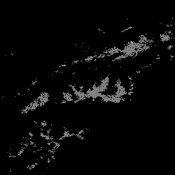
var dataset = ee.ImageCollection('LANDSAT/COMPOSITES/C02/T1_L2_ANNUAL_NBR')
                  .filterDate('2017-01-01', '2017-12-31');
var colorized = dataset.select('NBR');
var colorizedVis = {
  min: 0.9,
  max: 1.0,
  palette: ['000000', 'ffffff'],
};
Map.setCenter(6.746, 46.529, 6);
Map.addLayer(colorized, colorizedVis, 'Colorized');