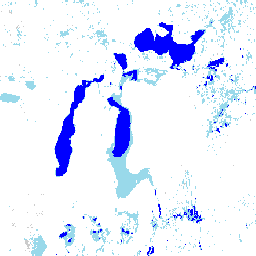
這個資料集包含 1984 年至 2019 年的地表水位置和時間分布情形,以及這些水域的面積和變化統計資料。詳情請參閱相關的期刊文章:High-resolution mapping of global surface water and its long-term changes (Nature, 2016) 和 …
[[["容易理解","easyToUnderstand","thumb-up"],["確實解決了我的問題","solvedMyProblem","thumb-up"],["其他","otherUp","thumb-up"]],[["缺少我需要的資訊","missingTheInformationINeed","thumb-down"],["過於複雜/步驟過多","tooComplicatedTooManySteps","thumb-down"],["過時","outOfDate","thumb-down"],["翻譯問題","translationIssue","thumb-down"],["示例/程式碼問題","samplesCodeIssue","thumb-down"],["其他","otherDown","thumb-down"]],[],[],["This dataset, derived from Landsat 5, 7, and 8 scenes (1984-2019), maps the location and temporal spread of surface water. It classifies each pixel as \"no data,\" \"not water,\" \"seasonal water,\" or \"permanent water,\" offering a yearly classification of water seasonality. The dataset, provided by EC JRC/Google, includes water extent statistics and changes across two epochs (1984-1999, 2000-2019). Data is freely available under the Copernicus Programme. The citation must be included when the data is used.\n"]]