
- 資料集開放期間
- 1992-10-02T00:00:00Z–2018-12-09T12:00:00Z
- 資料集產生者
- NOPP
- 觀測頻率
- 1 天
- 標記
說明
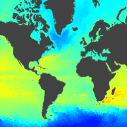
混合座標海洋模型 (HYCOM) 是一種資料同化混合等密度-sigma-壓力 (廣義) 座標海洋模型。EE 中代管的 HYCOM 資料子集包含鹽度、溫度、速度和海拔高度等變數。這些資料已插補到 80.48°S 和 80.48°N 之間,緯度/經度為 0.08 度的統一格線。鹽度、溫度和速度變數已插補至 40 個標準 z 層級。
HYCOM 聯盟 (包括國家海洋合作夥伴計畫 (NOPP)) 是美國全球海洋資料同化實驗 (GODAE) 的一部分。
由國家海洋合作夥伴計畫、海軍研究辦公室 (ONR) 和國防部高效能運算現代化計畫資助。
如需詳細資訊,請參閱:
- hycom.org
- GIS StackExchange hycom
- 維基百科 HyCOM
- 維基百科:洋流模式清單
- 維基百科:海洋環流模式 (OGCM)
頻帶
波段
像素大小:8905.6 公尺 (所有頻帶)
| 名稱 | 單位 | 最小值 | 最大值 | 縮放 | 像素大小 | 說明 |
|---|---|---|---|---|---|---|
surface_elevation |
公尺 | -5681* | 5965* | 0.001 | 8905.6 公尺 | 相對於模型化海拔高度平均值的海面海拔高度異常 |
圖片屬性
影像屬性
| 名稱 | 類型 | 說明 |
|---|---|---|
| 實驗組 | STRING | 實驗編號 |
使用條款
使用條款
這個資料集可免費使用,沒有任何限制。
參考資料
參考資料:
J. A. Cummings 和 O. M.,Smedstad。2013 年:全球海洋的變分資料同化。Data Assimilation for Atmospheric, Oceanic and Hydrologic Applications vol II, chapter 13, 303-343.
使用 Earth Engine 探索
程式碼編輯器 (JavaScript)
var dataset = ee.ImageCollection('HYCOM/GLBu0_08/sea_surface_elevation')
                  .filter(ee.Filter.date('2018-08-01', '2018-08-15'));
var surfaceElevation = dataset.select('surface_elevation');
var surfaceElevationVis = {
  min: -2000.0,
  max: 2000.0,
  palette: ['blue', 'cyan', 'yellow', 'red'],
};
Map.setCenter(-28.1, 28.3, 1);
Map.addLayer(surfaceElevation, surfaceElevationVis, 'Surface Elevation');