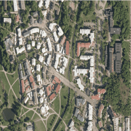
ระบุชื่อผู้อนุญาต (National Land Survey of Finland),
ชื่อชุดข้อมูล และเวลาที่ National Land Survey
ส่งชุดข้อมูล (เช่น มีข้อมูลจากฐานข้อมูลภูมิประเทศของ National Land Survey
of Finland 06/2014)
โปรดดูข้อกำหนดในการใช้งาน
[[["เข้าใจง่าย","easyToUnderstand","thumb-up"],["แก้ปัญหาของฉันได้","solvedMyProblem","thumb-up"],["อื่นๆ","otherUp","thumb-up"]],[["ไม่มีข้อมูลที่ฉันต้องการ","missingTheInformationINeed","thumb-down"],["ซับซ้อนเกินไป/มีหลายขั้นตอนมากเกินไป","tooComplicatedTooManySteps","thumb-down"],["ล้าสมัย","outOfDate","thumb-down"],["ปัญหาเกี่ยวกับการแปล","translationIssue","thumb-down"],["ตัวอย่าง/ปัญหาเกี่ยวกับโค้ด","samplesCodeIssue","thumb-down"],["อื่นๆ","otherDown","thumb-down"]],[],[],["The NLS Orthophotos dataset, provided by SMK, contains aerial photos of Finland from 2015 to 2023. The dataset, accessible via Google Earth Engine, features RGB bands with a 0.5-meter pixel size. Orthophotos, combining multiple aerial photos, are updated every 3 years. Usage requires citing the National Land Survey of Finland and dataset details, and adhere to the [Terms of use](https://creativecommons.org/licenses/by/4.0/). Data can be explored using Earth Engine's code editor with the provided code snippet.\n"]]