- ความพร้อมใช้งานของชุดข้อมูล
- 2009-01-01T00:00:00Z–2023-03-01T00:00:00Z
- ผู้ผลิตชุดข้อมูล
- FAO UN
- แผนการสนทนา
- 10 วัน
- แท็ก
คำอธิบาย
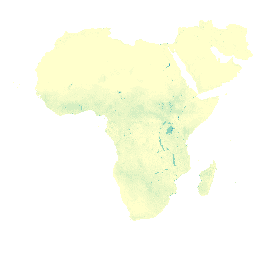
องค์ประกอบข้อมูลการระเหย (E) (dekadal ในหน่วยมม./วัน) คือการระเหยจริงของพื้นผิวดิน ค่าของแต่ละพิกเซลแสดงถึงการระเหยจริงเฉลี่ยรายวันสำหรับช่วง 10 วันนั้นๆ
ย่านความถี่
ย่านความถี่
ขนาดพิกเซล: 248.2 เมตร (ทุกแถบ)
| ชื่อ | หน่วย | ปรับขนาด | ขนาดพิกเซล | คำอธิบาย |
|---|---|---|---|---|
L1_E_D |
มม. | 0.1 | 248.2 เมตร | การระเหย (ทศางค์) [มม.] |
ข้อกำหนดในการใช้งาน
ข้อกำหนดในการใช้งาน
องค์การอาหารและเกษตรแห่งสหประชาชาติ (FAO) มี หน้าที่ในการรวบรวม วิเคราะห์ ตีความ และเผยแพร่ข้อมูลที่เกี่ยวข้อง กับโภชนาการ อาหาร และเกษตรกรรม ในเรื่องนี้ FAO ได้เผยแพร่ฐานข้อมูลจำนวนหนึ่งในหัวข้อที่เกี่ยวข้องกับอำนาจหน้าที่ของ FAO และสนับสนุนให้ใช้ฐานข้อมูลดังกล่าวเพื่อวัตถุประสงค์ทางวิทยาศาสตร์และการวิจัย ข้อมูลจากพอร์ทัลการเข้าถึงแบบเปิดด้านประสิทธิภาพการใช้น้ำ (WaPOR) ซึ่งเป็นส่วนหนึ่งของ AQUASTAT ซึ่งเป็นระบบข้อมูลทั่วโลกของ FAO เกี่ยวกับน้ำและการเกษตร เปิดให้ชุมชนผู้ใช้งานเข้าถึงได้ฟรี ตามหลักการ ของความเปิดกว้างและการแชร์ที่ระบุไว้ในการอนุญาตให้ใช้ข้อมูลแบบเปิดสำหรับ ฐานข้อมูลทางสถิติ และตามอำนาจหน้าที่ของ FAO
การอ้างอิง
FAO 2018 ระเบียบวิธีของฐานข้อมูล WaPOR: ระดับ 1 Remote Sensing for Water Productivity Technical Report: Methodology Series โรม, FAO. 72 หน้า
FAO 2020 ระเบียบวิธีฐานข้อมูล WaPOR V2 Remote Sensing for Water Productivity Technical Report: Methodology Series โรม, FAO https://www.fao.org/3/ca9894en/CA9894EN.pdf
สำรวจด้วย Earth Engine
ตัวแก้ไขโค้ด (JavaScript)
var coll = ee.ImageCollection('FAO/WAPOR/2/L1_E_D');
var image = coll.first();
Map.setCenter(17.5, 20, 3);
Map.addLayer(image, {min: 0, max: 10});