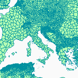
- Dataset Availability
- 2025-01-01T00:00:00Z–2025-12-31T00:00:00Z
- Dataset Producer
- FAO UN
- Tags
Description
The administrative boundaries dataset at level 2 (sub-national level) is part of the Global Administrative Unit Layers (GAUL 2025) dataset series which includes information on administrative units for all countries in the world, providing a contribution to the standardization of the spatial dataset representing administrative units.
The administrative boundaries at the level 2 dataset distinguishes Districts, Counties, Municipalities and equivalents.
The GAUL maintains global layers with a unified coding system at country, first (e.g. departments), and second administrative levels (e.g. districts). The overall GAUL methodology consists in a) collecting the best available data from most reliable sources, b) assembling national datasets into a common dataset by matching international boundaries with a reference authoritative dataset (UN 2018), c) standardizing attributes to a common table of attributes, d) generating codes using the GAUL Coding System, e) applying a topology, and f) validating metadata for each country (see Technical Guidelines of the GAUL 2024 Set). Note that some administrative units are multipolygon features.
Table Schema
Table Schema
| Name | Type | Description |
|---|---|---|
| FID | INT | Internal feature identifier |
| ISO3_CODE | STRING | ISO 3166-1 alpha-3 country code |
| MAP_CODE | STRING | Map code for statistical joins |
| GAUL0_CODE | INT | GAUL country code |
| GAUL0_NAME | STRING | Country name (UN standard) |
| GAUL1_CODE | INT | GAUL code of administrative units at first level |
| GAUL1_NAME | STRING | Name of administrative units at first level |
| GAUL2_CODE | INT | GAUL code of administrative units at second level |
| GAUL2_NAME | STRING | Name of administrative units at second level |
| CONTINENT | STRING | Continent name |
| DISP_EN | STRING | Hierarchical display label in English |
Terms of Use
Terms of Use
The designations employed and the presentation of material in this information product do not imply the expression of any opinion whatsoever on the part of FAO concerning the legal status of any country, territory, city or area or of its authorities, or concerning the delimitation of its frontiers or boundaries. Use of the FAO logo is strictly prohibited. CC-BY-4.0
Citations
FAO. 2025. Global Administrative Unit Layers (GAUL). https://data.apps.fao.org. Licence: CC-BY-4.0
Explore with Earth Engine
Code Editor (JavaScript)
var dataset = ee.FeatureCollection('FAO/GAUL/2025/level2');

Map.setCenter(12.876, 42.682, 5);

var styleParams = {
  fillColor: 'b5ffb4',
  color: '00909F',
  width: 1.0,
};

dataset = dataset.style(styleParams);

Map.addLayer(dataset, {}, 'Second Level Administrative Units');
Visualize as a FeatureView
A FeatureView is a view-only, accelerated representation of a
FeatureCollection. For more details, visit the
FeatureView documentation.
Code Editor (JavaScript)
var fvLayer = ui.Map.FeatureViewLayer('FAO/GAUL/2025/level2_FeatureView');

var visParams = {
  color: '00909F',
  fillColor: 'b5ffb4',
  opacity: 1,
  width: 1,
  pointSize: 1
};

fvLayer.setVisParams(visParams);
fvLayer.setName('Second Level Administrative Units');

Map.setCenter(12.876, 42.682, 5);
Map.add(fvLayer);