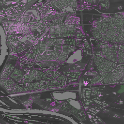
Actueel Hoogtebestand Nederland (AHN)는 네덜란드 전역의 상세하고 정확한 고도 데이터가 포함된 데이터 세트입니다. 고도 정보는 헬리콥터와 항공기에서 수직 정확도가 5cm인 레이저 기술을 사용하여 수집되었습니다. AHN4 데이터 세트에는 네덜란드 AHN 0.5m DSM 및 DTM 변수가 포함되어 있습니다. 데이터 …
[[["이해하기 쉬움","easyToUnderstand","thumb-up"],["문제가 해결됨","solvedMyProblem","thumb-up"],["기타","otherUp","thumb-up"]],[["필요한 정보가 없음","missingTheInformationINeed","thumb-down"],["너무 복잡함/단계 수가 너무 많음","tooComplicatedTooManySteps","thumb-down"],["오래됨","outOfDate","thumb-down"],["번역 문제","translationIssue","thumb-down"],["샘플/코드 문제","samplesCodeIssue","thumb-down"],["기타","otherDown","thumb-down"]],[],[],["The Actueel Hoogtebestand Nederland (AHN) AHN4 dataset provides detailed elevation data for the Netherlands from 2020 to 2022, collected via laser technology from aircraft. It includes Digital Surface Model (DSM) and Digital Terrain Model (DTM) variables at a 0.5-meter pixel size, representing the elevation of the tallest surfaces and the ground, respectively. The data is open and freely available under the CC-0 license for anyone. It can be accessed through Google Earth Engine using the `ee.ImageCollection(\"AHN/AHN4\")` snippet.\n"]]