비즈니스, 정부, 연구원, 언론인이 실제 세계를 이해하고 조치를 취할 수 있도록 지원합니다.
이제 사용자는 노르웨이 국제 기후 및 산림 이니셔티브 (NICFI)를 통해 Planet의 고해상도, 분석 준비가 완료된 전 세계 열대 지역 모자이크에 액세스하여 열대림 손실을 줄이고 되돌리며, 기후 변화에 대처하고, 생물 다양성을 보존하고, 비상업적 용도로 지속 가능한 개발을 촉진할 수 있습니다.
-
열대 우림 모니터링을 위한 NICFI 위성 데이터 프로그램 기본 지도 - 아프리카
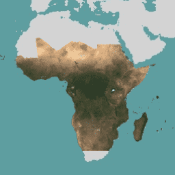
이 이미지 모음은 열대 지역의 고해상도 위성 모니터링에 대한 액세스를 제공하며, 그 주요 목적은 열대림 손실을 줄이고 되돌려 기후 변화에 대처하고, 생물 다양성을 보존하고, 산림 재성장, 복원, 개선에 기여하고, 지속 가능한 개발을 촉진하는 것입니다. basemaps forest nicfi planet planet-nicfi publisher-dataset -
열대 우림 모니터링을 위한 NICFI 위성 데이터 프로그램 기본 지도 - 아메리카
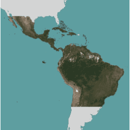
이 이미지 모음은 열대 지역의 고해상도 위성 모니터링에 대한 액세스를 제공하며, 그 주요 목적은 열대림 손실을 줄이고 되돌려 기후 변화에 대처하고, 생물 다양성을 보존하고, 산림 재성장, 복원, 개선에 기여하고, 지속 가능한 개발을 촉진하는 것입니다. basemaps forest nicfi planet planet-nicfi publisher-dataset -
열대림 모니터링을 위한 NICFI 위성 데이터 프로그램 기본 지도 - 아시아
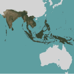
이 이미지 모음은 열대 지역의 고해상도 위성 모니터링에 대한 액세스를 제공하며, 그 주요 목적은 열대림 손실을 줄이고 되돌려 기후 변화에 대처하고, 생물 다양성을 보존하고, 산림 재성장, 복원, 개선에 기여하고, 지속 가능한 개발을 촉진하는 것입니다. basemaps forest nicfi planet planet-nicfi publisher-dataset