米国国立科学財団の National Ecological Observatory Network(NEON) は、Battelle が運営する大陸規模の観測施設で、米国の生態系の変化をより深く理解するために、長期的なオープンアクセス生態学的データを収集するように 設計されています。
NEON は、その場でのデータプロダクトに加えて、米国とプエルトリコの 81 か所の陸上および水生フィールド サイトで、生態学的研究とモニタリングのために、高解像度の航空機搭載リモートセンシング データを繰り返し提供しています。
-
NEON Canopy Height Model(CHM)
裸地の上の樹冠の高さ(Canopy Height Model、CHM)。CHM は NEON LiDAR ポイントクラウドから派生し、LiDAR 調査の空間ドメイン全体で樹冠の高さの推定値の連続面を作成することで生成されます。カラーは、RGB 値とアルファ チャンネルで指定します。 airborne canopy forest forest-biomass highres lidar -
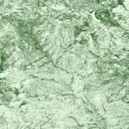
NEON Canopy Nitrogen Content(CNC)
NEON Imaging Spectrometer(NIS)から派生した L1 地表方向反射率で予測され、NEON 植物葉化学観測で校正された、モデル化された樹冠窒素濃度。バンドには、1)樹冠窒素パーセント、2)樹冠窒素モデルの不確実性、3)針葉樹モデルと非針葉樹モデルの分類結果、…が含まれます。 airborne canopy forest highres hyperspectral neon -
NEON Digital Elevation Model(DEM)
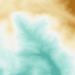
NEON LiDAR データから派生した地表(DSM)と地形(DTM)のデジタル モデル。DSM: 地表のフィーチャー(植生と人工構造物を含む地形情報)。DTM: 裸地の標高(植生と人工構造物を取り除いた地形情報)。画像は、海抜(メートル)で指定します。 airborne dem elevation-topography forest highres lidar -
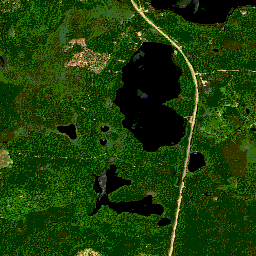
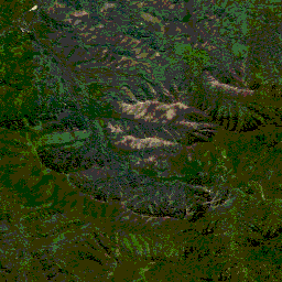
NEON RGB カメラ画像
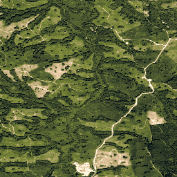
最近傍法によるリサンプリングを使用して、固定された均一な空間グリッドにモザイク処理して出力された、高解像度の赤、緑、青(RGB)の正射補正カメラ画像。空間解像度は 0.1 m です。デジタルカメラは、NEON Airborne Observation Platform(AOP)の一連の機器の一部であり、…も含まれています。 airborne forest highres neon neon-prod-earthengine orthophoto -
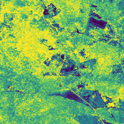
NEON 地表双方向反射率
NEON AOP 地表双方向反射率は、VSWIR(可視光から短波赤外線)のハイパースペクトル データプロダクトで、約 380 nm から 2, 510 nm の波長にまたがる 426 バンドが含まれています。反射率は 10,000 倍にスケーリングされます。1340 ~ 1445 nm と 1790 ~ 1955 nm の波長は … に設定されます。 airborne forest highres hyperspectral neon neon-prod-earthengine -
NEON 地表方向反射率
NEON AOP 地表方向反射率は、VSWIR(可視光から短波赤外線)のハイパースペクトル データプロダクトで、約 380 nm から 2, 510 nm の波長にまたがる 426 バンドが含まれています。反射率は 10,000 倍にスケーリングされます。1340 ~ 1445 nm と 1790 ~ 1955 nm の波長は … に設定されます。 airborne forest hyperspectral neon neon-prod-earthengine publisher-dataset