- Dataset Availability
- 2000-01-01T00:00:00Z–2025-01-01T00:00:00Z
- Dataset Producer
- CSIRO
- Cadence
- 1 Year
- Tags
Description
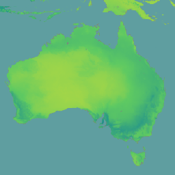
The CSIRO biodiversity indicators v4 dataset, produced by CSIRO using the BILBI (Biogeographic Infrastructure for Large-scale Biodiversity Indicators) framework, models global terrestrial biodiversity indicators at 30 arcsecond (~1 km) resolution annually from 2000 to 2024. These indicators provide a system-level view of change in biodiversity protection, expected persistence, and resilience in the face of climate change.
A complementary static global weighting surface is available as a standalone image at CSIRO/BHI/v4_weights. It represents summed compositional similarity across terrestrial pixels, which is used for calculating regional and global geometric aggregations of the biodiversity indicators.
For more detailed explanations of the indicators and how they are derived, see CSIRO Biodiversity Modelling.
Bands
Bands
Pixel size: 1000 meters (all bands)
| Name | Units | Pixel Size | Description |
|---|---|---|---|
bhi |
1000 meters | Biodiversity Habitat Index: Estimates the proportion of species diversity retained within each pixel as a function of the area, condition, and connectivity of natural ecosystems. |
|
beri |
1000 meters | Bioclimatic Ecosystem Resilience Index: Estimates the capacity of landscapes to retain species diversity in the face of climate change as a function of the area, condition, and connectivity of natural ecosystems across those landscapes. |
|
parc_rep |
1000 meters | Protected Area Representativeness: Estimates the extent to which a system of terrestrial protected areas is ecologically representative of the full range of environmental and biological diversity in any region. |
|
parc_con |
1000 meters | Protected Area Connectedness: Estimates the extent to which protected areas are functionally connected to one another and to other areas of intact natural ecosystems. |
|
ecosystem_condition |
% | 1000 meters | Ecosystem Condition: Estimates the biological integrity of any location compared to undisturbed reference states (0-100%). |
Terms of Use
Terms of Use
Citations
Ware, C., Valavi, R., Vickers, M., Giljohann, K., Mokany, K., Purvis, A., Walkden, P., De Palma, A., Duffin, C., Contu, S., Harwood, T., Hoskins, A., Ferrier, S. (2024). Global biodiversity indicator data for BHI, BERI, PARC-representativeness, PARC-connectedness and ecosystem condition (2000-2024). CSIRO. doi:10.25919/3aka-y730
DOIs
Explore with Earth Engine
Code Editor (JavaScript)
var dataset = ee.ImageCollection('CSIRO/BHI/v4');
var bhi = dataset.filter(ee.Filter.date('2024-01-01', '2025-01-01')).first().select('bhi');

var visualization = {
  min: 0.0,
  max: 1.0,
  palette: ['440154', '3b528b', '21918c', '5ec962', 'fde725']
};

Map.setCenter(133.78, -25.27, 4);
Map.addLayer(bhi, visualization, 'Biodiversity Habitat Index (BHI)');