**European Economic Area (EEA) developers**
> [!NOTE]
> If your billing address is in the European Economic Area, effective on 8 July 2025, the [Google
> Maps Platform EEA Terms of Service](https://cloud.google.com/terms/maps-platform/eea) will apply to your use of the Services. [Learn more](https://developers.google.com/maps/comms/eea/faq.md.txt). In addition, certain content from the Map Tiles API will no longer be returned. [Learn more](https://developers.google.com/maps/comms/eea/map-tiles.md.txt).
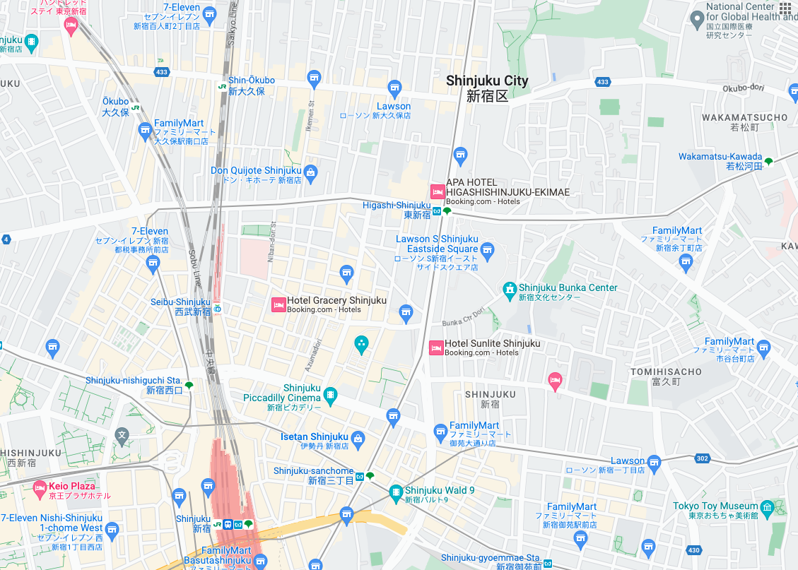Roadmap tiles are image tiles based on vector topographic data
with Google's cartographic styling. This includes roads, buildings, points
of interest, and political boundaries.
## Getting roadmap tiles
You can begin making roadmap tile requests after you get a session token. Because the
session token applies to the entire session, you don't have to specify the map
options with your tile requests.
The following code sample demonstrates a typical session token request for
roadmap tiles.
```json
curl -X POST -d '{
"mapType": "roadmap",
"language": "en-US",
"region": "US"
}' \
-H 'Content-Type: application/json' \
"https://tile.googleapis.com/v1/createSession?key=YOUR_API_KEY"
```
You get roadmap tiles by making an HTTPS GET request, as shown in the following
example.
```json
curl "https://tile.googleapis.com/v1/2dtiles/z/x/y?session=YOUR_SESSION_TOKEN&key=YOUR_API_KEY&orientation=0_or_90_or_180_or_270"
```
In this HTTPS GET request, `z` is the zoom level
(ranging from 0 to 22), and `x` and
`y` are the
[tile coordinates](https://developers.google.com/maps/documentation/javascript/coordinates.md.txt#tile-coordinates)
of the tile you want to retrieve.
> [!NOTE]
> **Note:** Tile coordinates are not the same as geographic coordinates. For more information about tile coordinates, see [Map and tile coordinates](https://developers.google.com/maps/documentation/javascript/coordinates.md.txt) in the Maps JavaScript API documentation.
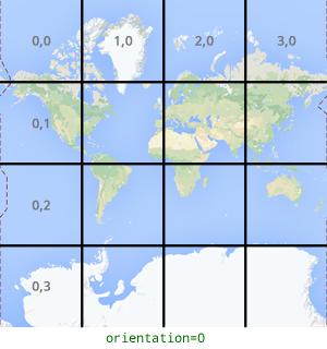
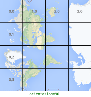
The `orientation` parameter is optional. Its value specifies the number of
degrees of counter-clockwise rotation of the tile image. `orientation` is
supported for `roadmap` tiles, and it's also supported for satellite and
terrain requests with base imagery removed using `"overlay": true`, and with
`layerTypes` set. Valid `orientation` values are 0 (the default), 90, 180, and
270.
The tile coordinate grid isn't rotated if you include an `orientation`
value. For example, if you set `orientation` to 90, then the
`x` coordinate still defines the left-to-right
position of the tile, which in this case is from North to South on the map.
| Zero-degrees orientation | 90-degrees orientation |
|---|---|
|  |  |
## Example tile request
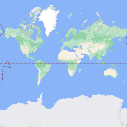
Consider the following example, which requests a single tile that contains the
entire world. In this example, zoom level is 0, and the x and y coordinates are
0, 0.
```json
curl "https://tile.googleapis.com/v1/2dtiles/0/0/0?session=YOUR_SESSION_TOKEN&key=YOUR_API_KEY" --output /tmp/example_tile.png
```
There is no response message from the server in this example. Instead, the tile
downloads to a local file, with the following statistics.
```bash
% Total % Received % Xferd Average Speed Time Time Time Current
Dload Upload Total Spent Left Speed
100 8335 100 8335 0 0 51471 0 --:--:-- --:--:-- --:--:-- 54835
```
For information about response message headers, see
[Pre-Fetching, Caching, or Storage of Content](https://developers.google.com/maps/documentation/tile/policies.md.txt#pre-fetching,-caching,-or-storage-of-content).