-
ERA5 Daily Aggregates - Latest Climate Reanalysis Produced by ECMWF / Copernicus Climate Change Service
NOTE (2024-04-19): Due to modernization work impacting the Copernicus Climate Data Store, production of ECMWF datasets may be disrupted. The provider did not specify a planned completion date, so for more details, see the user forum. ERA5 is the fifth generation ECMWF atmospheric reanalysis of … climate copernicus dewpoint ecmwf era5 precipitation -
ERA5 Monthly Aggregates - Latest Climate Reanalysis Produced by ECMWF / Copernicus Climate Change Service

NOTE (2024-04-19): Due to modernization work impacting the Copernicus Climate Data Store, production of ECMWF datasets may be disrupted. The provider did not specify a planned completion date, so for more details, see the user forum. ERA5 is the fifth generation ECMWF atmospheric reanalysis of … climate copernicus dewpoint ecmwf era5 precipitation -
ERA5-Land Daily Aggregated - ECMWF Climate Reanalysis
NOTE (2024-04-19): Due to modernization work impacting the Copernicus Climate Data Store, production of ECMWF datasets may be disrupted. The provider did not specify a planned completion date, so for more details, see the user forum. ERA5-Land is a reanalysis dataset providing a consistent view … cds climate copernicus ecmwf era5-land evaporation -
ERA5-Land Hourly - ECMWF Climate Reanalysis

NOTE (2024-04-19): Due to modernization work impacting the Copernicus Climate Data Store, production of ECMWF datasets may be disrupted. The provider did not specify a planned completion date, so for more details, see the user forum. ERA5-Land is a reanalysis dataset providing a consistent view … cds climate copernicus ecmwf era5-land evaporation -
ERA5-Land Monthly Aggregated - ECMWF Climate Reanalysis
NOTE (2024-04-19): Due to modernization work impacting the Copernicus Climate Data Store, production of ECMWF datasets may be disrupted. The provider did not specify a planned completion date, so for more details, see the user forum. ERA5-Land is a reanalysis dataset providing a consistent view … cds climate copernicus ecmwf era5-land evaporation -
ERA5-Land Monthly Averaged by Hour of Day - ECMWF Climate Reanalysis
NOTE (2024-04-19): Due to modernization work impacting the Copernicus Climate Data Store, production of ECMWF datasets may be disrupted. The provider did not specify a planned completion date, so for more details, see the user forum. ERA5-Land is a reanalysis dataset providing a consistent view … cds climate copernicus ecmwf era5-land evaporation -
GLDAS-2.1: Global Land Data Assimilation System
NASA Global Land Data Assimilation System Version 2 (GLDAS-2) has three components: GLDAS-2.0, GLDAS-2.1, and GLDAS-2.2. GLDAS-2.0 is forced entirely with the Princeton meteorological forcing input data and provides a temporally consistent series from 1948 through 2014. GLDAS-2.1 is forced with a combination of model … 3-hourly climate evaporation forcing geophysical gldas -
GLDAS-2.2: Global Land Data Assimilation System

NASA Global Land Data Assimilation System Version 2 (GLDAS-2) has three components: GLDAS-2.0, GLDAS-2.1, and GLDAS-2.2. GLDAS-2.0 is forced entirely with the Princeton meteorological forcing input data and provides a temporally consistent series from 1948 through 2014. GLDAS-2.1 is forced with a combination of model … 3-hourly climate evaporation forcing geophysical gldas -
Reprocessed GLDAS-2.0: Global Land Data Assimilation System

NASA Global Land Data Assimilation System Version 2 (GLDAS-2) has three components: GLDAS-2.0, GLDAS-2.1, and GLDAS-2.2. GLDAS-2.0 is forced entirely with the Princeton meteorological forcing input data and provides a temporally consistent series from 1948 through 2014. GLDAS-2.1 is forced with a combination of model … 3-hourly climate evaporation forcing geophysical gldas -
MERRA-2 M2T1NXSLV: Single-Level Diagnostics V5.12.4
M2T1NXSLV (or tavg1_2d_slv_Nx) is an hourly time-averaged 2-dimensional data collection in Modern-Era Retrospective analysis for Research and Applications version 2 (MERRA-2). This collection consists of meteorology diagnostics at popularly used vertical levels, such as air temperature at 2-meter (or at 10-meter, 850hPa, 500 hPa, 250hPa), … humidity merra nasa pressure temperature vapor -
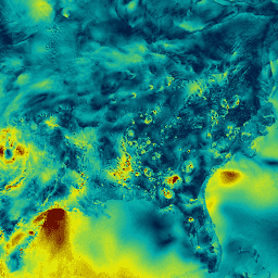
NLDAS-2: North American Land Data Assimilation System Forcing Fields
Land Data Assimilation System (LDAS) combines multiple sources of observations (such as precipitation gauge data, satellite data, and radar precipitation measurements) to produce estimates of climatological properties at or near the Earth''s surface. This dataset is the primary (default) forcing file (File A) for Phase … climate evaporation forcing geophysical hourly humidity -
NCEP/NCAR Reanalysis Data, Sea-Level Pressure
The NCEP/NCAR Reanalysis Project is a joint project between the National Centers for Environmental Prediction (NCEP, formerly "NMC") and the National Center for Atmospheric Research (NCAR). The goal of this joint effort is to produce new atmospheric analyses using historical data as well as to … atmosphere climate geophysical ncep noaa pressure -
RTMA: Real-Time Mesoscale Analysis
The Real-Time Mesoscale Analysis (RTMA) is a high-spatial and temporal resolution analysis for near-surface weather conditions. This dataset includes hourly analyses at 2.5 km for CONUS. climate cloud geophysical humidity noaa nws -
PRISM Daily Spatial Climate Dataset AN81d
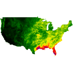
The PRISM daily and monthly datasets are gridded climate datasets for the conterminous United States, produced by the PRISM Climate Group at Oregon State University. Grids are developed using PRISM (Parameter-elevation Regressions on Independent Slopes Model). PRISM interpolation routines simulate how weather and climate vary … climate daily geophysical oregonstate precipitation pressure -
PRISM Monthly Spatial Climate Dataset AN81m

The PRISM daily and monthly datasets are gridded climate datasets for the conterminous United States, produced by the PRISM Climate Group at Oregon State University. Grids are developed using PRISM (Parameter-elevation Regressions on Independent Slopes Model). PRISM interpolation routines simulate how weather and climate vary … climate geophysical monthly oregonstate precipitation pressure -
PRISM Long-Term Average Climate Dataset Norm91m

The PRISM daily and monthly datasets are gridded climate datasets for the conterminous United States, produced by the PRISM Climate Group at Oregon State University. Grids are developed using PRISM (Parameter-elevation Regressions on Independent Slopes Model). PRISM interpolation routines simulate how weather and climate vary … climate geophysical oregonstate precipitation pressure prism
[{
"type": "thumb-down",
"id": "missingTheInformationINeed",
"label":"Missing the information I need"
},{
"type": "thumb-down",
"id": "tooComplicatedTooManySteps",
"label":"Too complicated / too many steps"
},{
"type": "thumb-down",
"id": "outOfDate",
"label":"Out of date"
},{
"type": "thumb-down",
"id": "samplesCodeIssue",
"label":"Samples / code issue"
},{
"type": "thumb-down",
"id": "otherDown",
"label":"Other"
}]
[{
"type": "thumb-up",
"id": "easyToUnderstand",
"label":"Easy to understand"
},{
"type": "thumb-up",
"id": "solvedMyProblem",
"label":"Solved my problem"
},{
"type": "thumb-up",
"id": "otherUp",
"label":"Other"
}]