-
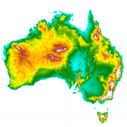
Australian 5M DEM
The Digital Elevation Model (DEM) 5 meter Grid of Australia derived from LiDAR model represents a National 5 meter (bare earth) DEM which has been derived from some 236 individual LiDAR surveys between 2001 and 2015 covering an area in excess of 245,000 square kilometers. … australia dem elevation ga geophysical geoscience-australia -
DEM-H: Australian SRTM Hydrologically Enforced Digital Elevation Model

The Hydrologically Enforced Digital Elevation Model (DEM-H) was derived from the SRTM data acquired by NASA in February 2000. The model has been hydrologically conditioned and drainage enforced. The DEM-H captures flow paths based on SRTM elevations and mapped stream lines, and supports delineation of … australia dem elevation ga geophysical geoscience-australia -
DEM-S: Australian Smoothed Digital Elevation Model
The Smoothed Digital Elevation Model (DEM-S) was derived from the SRTM data acquired by NASA in February 2000. DEM-S represents ground surface topography (excluding vegetation features) and has been smoothed to reduce noise and improve the representation of surface shape. An adaptive process applied more … australia dem elevation ga geophysical geoscience-australia -
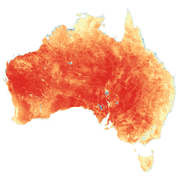
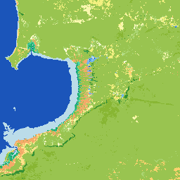
SLGA: Soil and Landscape Grid of Australia (Soil Attributes)
The Soil and Landscape Grid of Australia (SLGA) is a comprehensive dataset of soil attributes across Australia at 3 arc-second resolution (~90m pixels). The surfaces are the outcomes from modelling that describe the spatial distribution of the soil attributes using existing soil data and environmental … australia csiro soil tern -
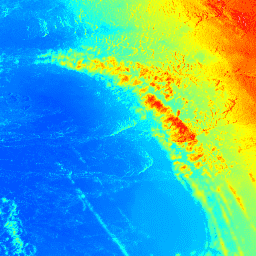
Actual Evapotranspiration for Australia (CMRSET Landsat V2.2)
This dataset provides accurate actual evapotranspiration (AET or ETa) for Australia using the CMRSET algorithm. The AET band (named 'ETa') contains the average daily value from the CMRSET model for all cloud-free Landsat observations in that month (indicated with value 3 in the AET Data … agriculture australia csiro evaporation evapotranspiration hydrology -
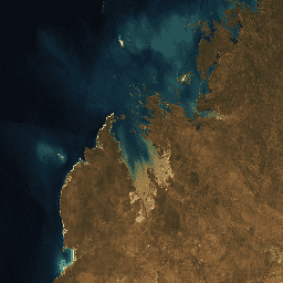
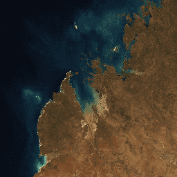
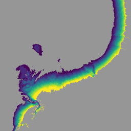
National Intertidal Digital Elevation Model 25m 1.0.0

The National Intertidal Digital Elevation Model (NIDEM; Bishop-Taylor et al. 2018, 2019) is a continental-scale elevation dataset for Australia's exposed intertidal zone. NIDEM provides the first three-dimensional representation of Australia's intertidal sandy beaches and shores, tidal flats and rocky shores and reefs at 25 m … australia dem ga geoscience-aus-cat landsat-derived publisher-dataset -
DEA Geometric Median and Median Absolute Deviation - Landsat 5 3.1.0
This product provides statistical tools to exploit the time series of Landsat 5 data available in Digital Earth Australia, providing annual images of general conditions and how much an area changes for a given year. The geomedian part of the product provides an "average" cloud-free … australia ga geoscience-aus-cat landsat-derived publisher-dataset -
DEA Geometric Median and Median Absolute Deviation - Landsat 7 3.1.0
This product provides statistical tools to exploit the time series of Landsat 7 data available in Digital Earth Australia, providing annual images of general conditions and how much an area changes for a given year. The geomedian part of the product provides an "average" cloud-free … australia ga geoscience-aus-cat landsat-derived publisher-dataset -
DEA Geometric Median and Median Absolute Deviation - Landsat 8 3.1.0
This product provides statistical tools to exploit the time series of Landsat 8 data available in Digital Earth Australia, providing annual images of general conditions and how much an area changes for a given year. The geomedian part of the product provides an "average" cloud-free … australia ga geoscience-aus-cat landsat-derived publisher-dataset -
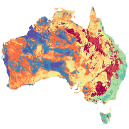
DEA Land Cover 1.0.0
Digital Earth Australia (DEA) Land Cover provides annual land cover classifications for Australia using the Food and Agriculture Organisation Land Cover Classification System taxonomy Version 2 (Di Gregorio and Jansen, 1998; 2005). DEA Land Cover translates over 30 years of satellite imagery into evidence of … australia ga geoscience-aus-cat landcover landsat-derived publisher-dataset -
DEA Water Observations Statistics 3.1.6

Digital Earth Australia (DEA) Water Observations uses an algorithm to classify each pixel from Landsat satellite imagery as 'wet', 'dry', or 'invalid'. Water Observations Statistics provides information on how many times each year the Landsat satellites were able to clearly see an area, how many … australia ga geoscience-aus-cat landsat-derived publisher-dataset water -
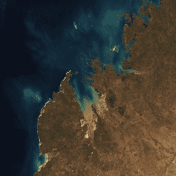
Preview National Intertidal Digital Elevation Model 25m 1.0.0
The National Intertidal Digital Elevation Model (NIDEM; Bishop-Taylor et al. 2018, 2019) is a continental-scale elevation dataset for Australia's exposed intertidal zone. NIDEM provides the first three-dimensional representation of Australia's intertidal sandy beaches and shores, tidal flats and rocky shores and reefs at 25 m … australia dem ga
[{
"type": "thumb-down",
"id": "missingTheInformationINeed",
"label":"Missing the information I need"
},{
"type": "thumb-down",
"id": "tooComplicatedTooManySteps",
"label":"Too complicated / too many steps"
},{
"type": "thumb-down",
"id": "outOfDate",
"label":"Out of date"
},{
"type": "thumb-down",
"id": "samplesCodeIssue",
"label":"Samples / code issue"
},{
"type": "thumb-down",
"id": "otherDown",
"label":"Other"
}]
[{
"type": "thumb-up",
"id": "easyToUnderstand",
"label":"Easy to understand"
},{
"type": "thumb-up",
"id": "solvedMyProblem",
"label":"Solved my problem"
},{
"type": "thumb-up",
"id": "otherUp",
"label":"Other"
}]