- Dataset Availability
- 2000-01-01T00:00:00Z–2021-01-01T00:00:00Z
- Dataset Provider
- WorldPop
- Earth Engine Snippet
-
ee.ImageCollection("WorldPop/GP/100m/pop") - Tags
Description
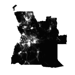
Global high-resolution, contemporary data on human population distributions are a prerequisite for the accurate measurement of the impacts of population growth, for monitoring changes, and for planning interventions. The WorldPop project aims to meet these needs through the provision of detailed and open access population distribution datasets built using transparent and peer-reviewed approaches.
Full details on the methods and datasets used in constructing the data, along with open access publications, are provided on the WorldPop website. In brief, recent census-based population counts matched to their associated administrative units are disaggregated to ~100x100m grid cells through machine learning approaches that exploit the relationships between population densities and a range of geospatial covariate layers. The mapping approach is Random Forest-based dasymetric redistribution.
This dataset depict estimated number of people residing in each grid cell in 2010, 2015, and other years.
For 2020, the breakdown of population by age and sex is available in the WorldPop/GP/100m/pop_age_sex and WorldPop/GP/100m/pop_age_sex_cons_unadj collections.
Further WorldPop gridded datasets on population age structures, poverty, urban growth, and population dynamics are freely available on the WorldPop website. WorldPop represents a collaboration between researchers at the University of Southampton, Universite Libre de Bruxelles, and University of Louisville. The project is principally funded by the Bill and Melinda Gates Foundation.
Bands
Resolution
92.77 meters
Bands
| Name | Min | Max | Description |
|---|---|---|---|
population |
0* | 21171* | Estimated number of people residing in each grid cell |
Image Properties
Image Properties
| Name | Type | Description |
|---|---|---|
| country | STRING | Country |
| year | DOUBLE | Year |
Terms of Use
Terms of Use
WorldPop datasets are licensed under the Creative Commons Attribution 4.0 International License. Users are free to use, copy, distribute, transmit, and adapt the work for commercial and non-commercial purposes, without restriction, as long as clear attribution of the source is provided.
Citations
Please cite the WorldPop website as the source: www.worldpop.org.
Americas population data: Alessandro Sorichetta, Graeme M. Hornby, Forrest R. Stevens, Andrea E. Gaughan, Catherine Linard, Andrew J. Tatem, 2015, High-resolution gridded population datasets for Latin America and the Caribbean in 2010, 2015, and 2020, Scientific Data, doi:10.1038/sdata.2015.45
Africa population count data: Linard, C., Gilbert, M., Snow, R.W., Noor, A.M. and Tatem, A.J., 2012, Population distribution, settlement patterns and accessibility across Africa in 2010, PLoS ONE, 7(2): e31743.
Asia population count data: Gaughan AE, Stevens FR, Linard C, Jia P and Tatem AJ, 2013, High resolution population distribution maps for Southeast Asia in 2010 and 2015, PLoS ONE, 8(2): e55882.
DOIs
Explore with Earth Engine
Code Editor (JavaScript)
var dataset = ee.ImageCollection('WorldPop/GP/100m/pop');

var visualization = {
  bands: ['population'],
  min: 0.0,
  max: 50.0,
  palette: ['24126c', '1fff4f', 'd4ff50']
};

Map.setCenter(113.643, 34.769, 7);

Map.addLayer(dataset, visualization, 'Population');