- Dataset Availability
- 1996-01-01T00:00:00Z–1996-01-01T00:00:00Z
- Dataset Provider
- United States Geological Survey
- Earth Engine Snippet
-
ee.Image("USGS/GTOPO30") - Tags
Description
GTOPO30 is a global digital elevation model (DEM) with a horizontal grid spacing of 30 arc seconds (approximately 1 kilometer). The DEM was derived from several raster and vector sources of topographic information. Completed in late 1996, GTOPO30 was developed over a three-year period through a collaborative effort led by the U.S. Geological Survey''s Center for Earth Resources Observation and Science (EROS). The following organizations participated by contributing funding or source data: the National Aeronautics and Space Administration (NASA), the United Nations Environment Programme/Global Resource Information Database (UNEP/GRID), the U.S. Agency for International Development (USAID), the Instituto Nacional de Estadistica Geografica e Informatica (INEGI) of Mexico, the Geographical Survey Institute (GSI) of Japan, Manaaki Whenua Landcare Research of New Zealand, and the Scientific Committee on Antarctic Research (SCAR).
Bands
Bands
| Name | Units | Min | Max | Pixel Size | Description |
|---|---|---|---|---|---|
elevation |
m | -407* | 8752* | 927.67 meters | Elevation |
Terms of Use
Terms of Use
There are no restrictions on the use of data received from the U.S. Geological Survey's Earth Resources Observation and Science (EROS) Center. For more information, visit the USGS' Data Use and Citation page.
Citations
GTOPO30 DEM courtesy of the U.S. Geological Survey
Explore with Earth Engine
Code Editor (JavaScript)
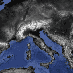
var dataset = ee.Image('USGS/GTOPO30');
var elevation = dataset.select('elevation');
var elevationVis = {
  min: -10.0,
  max: 8000.0,
  gamma: 1.6,
};
Map.setCenter(11.69, 43.9, 4);
Map.addLayer(elevation, elevationVis, 'Elevation');